-
Federal
Global Monthly and Seasonal Urban and Land Backscatter Time Series, 1993-2020
National Aeronautics and Space Administration —
The Global Monthly and Seasonal Urban and Land Backscatter Time Series, 1993-2020, is a multi-sensor, multi-decadal, data set of global microwave backscatter, for... -
Federal
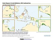
Global Mangrove Forests Distribution, 2000
National Aeronautics and Space Administration —
The Global Mangrove Forests Distribution, 2000 data set is a compilation of the extent of mangroves forests from the Global Land Survey and the Landsat archive with... -
Federal
Country-Level Population and Downscaled Projections Based on the SRES A1, B1, and A2 Scenarios, 1990-2100
National Aeronautics and Space Administration —
The Country-Level Population and Downscaled Projections Based on Special Report on Emissions Scenarios (SRES) A1, B1, and A2 Scenarios, 1990-2100, were adopted in... -
Federal
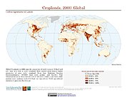
Global Agricultural Lands: Croplands, 2000
National Aeronautics and Space Administration —
The Global Croplands data set represents the proportion of land areas used as cropland (land used for the cultivation of food) in the year 2000. Satellite data from... -
Federal
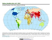
Gridded Population of the World, Version 4 (GPWv4): National Identifier Grid, Revision 11
National Aeronautics and Space Administration —
The Gridded Population of the World, Version 4 (GPWv4): National Identifier Grid, Revision 11 is a raster representation of nation-states in GPWv4 for use in... -
Federal
Global High Resolution Daily Extreme Urban Heat Exposure (UHE-Daily), 1983-2016
National Aeronautics and Space Administration —
The Global High Resolution Daily Extreme Urban Heat Exposure (UHE-Daily), 1983-2016 data set contains a high-resolution, longitudinal global record of geolocated... -
Federal
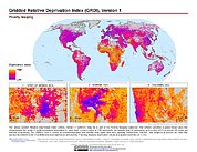
Global Gridded Relative Deprivation Index (GRDI), Version 1
National Aeronautics and Space Administration —
The Global Gridded Relative Deprivation Index (GRDI), Version 1 (GRDIv1) data set characterizes the relative levels of multidimensional deprivation and poverty in... -
Federal
Gridded Species Distribution: Global Amphibian Richness Grids, 2015 Release
National Aeronautics and Space Administration —
The 2015 Release of the Global Amphibian Richness Grids data set of the Gridded Species Distribution collection are aggregations of the presence grids data for the... -
Federal
Global Fire Emissions Indicators, Country-Level Tabular Data: 1997-2015
National Aeronautics and Space Administration —
The Global Fire Emissions Indicators, Country-Level Tabular Data: 1997-2015 contains country tabulations from 1997 to 2015 for the total area burned (hectares) and... -
Federal
CODATA Catalog of Roads Data Sets, Version 1
National Aeronautics and Space Administration —
The CODATA Catalog of Roads Data Sets, Version 1 contains 367 entries describing national-level road network data sets for 147 countries and four entries describing... -
Federal
2008 Environmental Performance Index (EPI)
National Aeronautics and Space Administration —
The 2008 Environmental Performance Index (EPI) centers on two broad environmental protection objectives: (1) reducing environmental stresses on human health, and (2)... -
Federal
IPCC Special Report on Emissions Scenarios (SRES) 1x1 Degree Gridded Emissions Dataset
National Aeronautics and Space Administration —
The Intergovernmental Panel on Climate Change (IPCC) Special Report on Emissions Scenarios (SRES) 1x1 Degree Gridded Emissions Dataset consists of global gridded... -
Federal
Natural Resource Protection and Child Health Indicators, 2012 Release
National Aeronautics and Space Administration —
The Natural Resource Protection and Child Health Indicators, 2012 Release, are produced in support of the U.S. Millennium Challenge Corporation as selection criteria... -
Federal
West Africa Coastal Vulnerability Mapping: Subset of Global Mammal and Amphibian Richness Grids, 2015 Release
National Aeronautics and Space Administration —
The West Africa Coastal Vulnerability Mapping: Subset of Global Mammal and Amphibian Richness Grids, 2015 Release was extracted from the NASA Socioeconomic Data and... -
Federal
U.S. EPA National Priorities List (NPL) Sites Point Data with CIESIN Modifications, Version 2
National Aeronautics and Space Administration —
The U.S. Environmental Protection Agency (EPA) National Priorities List (NPL) Sites Point Data with CIESIN Modifications, Version 2 is a modified version of the 2014... -
Federal
Millennium Ecosystem Assessment: MA Population
National Aeronautics and Space Administration —
The Millennium Ecosystem Assessment: MA Population provides data and information on baseline population as one of the drivers of ecosystem change. The data was used... -
Federal
IPCC Special Report on Emissions Scenarios (SRES) Fluor-Gases Emissions Dataset
National Aeronautics and Space Administration —
The Intergovernmental Panel on Climate Change (IPCC) Special Report Emissions Scenarios (SRES) Fluor-Gases Emissions Dataset consists of global and regional emissions... -
Federal
Global Earthquake Mortality Risks and Distribution
National Aeronautics and Space Administration —
The Global Earthquake Mortality Risks and Distribution is a 2.5 minute grid of global earthquake mortality risks. Gridded Population of the World, Version 3 (GPWv3)... -
Federal
Global One-Eighth Degree Urban Land Extent Projection and Base Year Grids by SSP Scenarios, 2000-2100
National Aeronautics and Space Administration —
The Global One-Eighth Degree Urban Land Extent Projection and Base Year Grids by SSP Scenarios, 2000-2100 consists of global SSP-consistent spatial urban land... -
Federal
Gridded Population of the World, Version 4 (GPWv4): Administrative Unit Center Points with Population Estimates, Revision 11
National Aeronautics and Space Administration —
The Gridded Population of the World, Version 4 (GPWv4): Administrative Unit Center Points with Population Estimates, Revision 11 consists of UN WPP-adjusted...

Official websites use .gov
A
.gov website belongs to an official government
organization in the United States.
Secure .gov websites use HTTPS
A
lock (
) or https:// means you’ve safely connected to
the .gov website. Share sensitive information only on official,
secure websites.