
-
Federal
AIRSAR_ALONGTRACK_INTERFEROMETRY_JPG
National Aeronautics and Space Administration —
AIRSAR along-track interferometric browse product JPG -
Federal
TES/Aura L2 Carbonyl Sulfide Nadir V007
National Aeronautics and Space Administration —
TL2OCSN_7 is the Tropospheric Emission Spectrometer (TES)/Aura Level 2 Atmospheric Temperatures Limb Version 7 data product. TES was an instrument aboard NASA's Aura... -
Federal
Sentinel-3B OLCI Level-3M Global Mapped Earth-observation Reduced Resolution (ERR) Chlorophyll (CHL) - Near Real-time (NRT) Data, version R2022.0
National Aeronautics and Space Administration —
The Ocean Biology DAAC produces near real-time (quicklook) products using the best-available combination of ancillary data from meteorological and ozone data. As... -
Federal
SMAP_L1A_RADAR_RECEIVE_ONLY_QA_V002
National Aeronautics and Space Administration —
SMAP Level 1A Radar Receive Only Data Quality Information Version 2 -
Federal
Global Gridded Relative Deprivation Index (GRDI), Version 1
National Aeronautics and Space Administration —
The Global Gridded Relative Deprivation Index (GRDI), Version 1 (GRDIv1) data set characterizes the relative levels of multidimensional deprivation and poverty in... -
Federal
OCO-2 Level 1A collated, parsed, calibration data V11.2 (OCO2_L1aIn_Pixel) at GES DISC
National Aeronautics and Space Administration —
Version 11.2 is the current version of the data set. Older versions will no longer be available and are superseded by Version 11.2. The Orbiting Carbon Observatory is... -
Federal
ABoVE: Landsat-derived Annual Dominant Land Cover Across ABoVE Core Domain, 1984-2014
National Aeronautics and Space Administration —
This dataset provides two 30-m resolution time series products of annual land cover classifications over the Arctic Boreal Vulnerability Experiment (ABoVE) core... -
Federal
SMAPVEX16 Manitoba Soils Geodatabase V001
National Aeronautics and Space Administration —
This data set contains detailed soil survey data used for the Soil Moisture Active Passive Validation Experiment 2016 Manitoba (SMAPVEX16 Manitoba) campaign. Data are... -
Federal
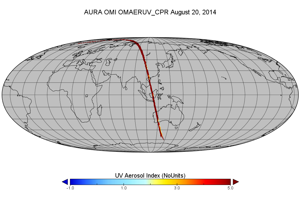
OMI/Aura Level 2 Near UV Aerosol Optical Depth and Single Scattering Albedo 200-m swath subset along CloudSat track V003 (OMAERUV_CPR) at GES DISC
National Aeronautics and Space Administration —
This is a CloudSat-collocated subset of the original OMI product OMAERUV, for the purposes of the A-Train mission. The goal of the subset is to select and return OMI... -
Federal
GPM Ground Validation Duke Micro Rain Radar (MRR) IPHEx V1
National Aeronautics and Space Administration —
The GPM Ground Validation Duke Micro Rain Radar (MRR) IPHEx dataset was gathered during the Global Precipitation Measurement (GPM) Ground Validation Integrated... -
Federal
National Assessment of Oil and Gas Project - Utica Shale Unconventional Assessment
Department of the Interior —
The Assessment Unit is the fundamental unit used in the National Assessment Project for the assessment of undiscovered oil and gas resources. The Assessment Unit is... -
Federal
ACT-America: Gridded Ensembles of Surface Biogenic Carbon Fluxes, 2003-2019
National Aeronautics and Space Administration —
This data set provides gridded, model-derived gross primary productivity (GPP), ecosystem respiration (RECO), and net ecosystem exchange (NEE) of CO2 biogenic fluxes... -
Federal
Aqua MODIS Global Mapped Normalized Difference Vegetation Index Land Reflectance Data, version R2022.0 NGDA
National Aeronautics and Space Administration —
MODIS (or Moderate-Resolution Imaging Spectroradiometer) is a key instrument aboard the Terra (EOS AM) and Aqua (EOS PM) satellites. Terra's orbit around the Earth is... -
Federal
National Assessment of Oil and Gas Project - Powder River Basin Province (033) Maughan and Perry Lineaments
Department of the Interior —
This dataset represents lineaments in the Powder River Basin as identified in the following publication: Maughan, E.K., and Perry, W.J., Jr., 1986, Lineaments and... -
Federal
Suomi-NPP VIIRS Global Binned Normalized Difference Vegetation Index Land Reflectance Data, version R2022.0
National Aeronautics and Space Administration —
The Visible and Infrared Imager/Radiometer Suite (VIIRS) is a multi-disciplinary instrument that is being flown on the Joint Polar Satellite System (JPSS) series of... -
Federal
TES/Aura L2 Methanol Nadir Special Observation V007
National Aeronautics and Space Administration —
TL2MTLNS_7 is the Tropospheric Emission Spectrometer (TES)/Aura Level 2 Methanol Nadir Special Observation Version 7 data product. It consists of information for one... -
Federal
Heat Capacity Mapping Mission Digital Source
National Aeronautics and Space Administration —
The HCMM Digital Source dataset includes approximately 2400 scenes of recovered digital data with a resolution of 100 dpi. The original scenes are 715 km wide and... -
Federal
NOAA-20 VIIRS Level-3 Global Binned Triple-window Sea Surface Temperature (SST3) - Near Real-time (NRT) Data, version R2024.0
National Aeronautics and Space Administration —
The Ocean Biology DAAC produces near real-time (quicklook) products using the best-available combination of ancillary data from meteorological and ozone data. As... -
Federal
Earth+
National Aeronautics and Space Administration —
Earth+ makes NASA satellite photos and data accessible to blind students. -
Federal
National Assessment of Oil and Gas Project - San Juan Basin Province (022) Boundary
Department of the Interior —
The USGS Central Region Energy Team assesses oil and gas resources of the United States. The onshore and State water areas of the United States comprise 71 provinces....

Official websites use .gov
A
.gov website belongs to an official government
organization in the United States.
Secure .gov websites use HTTPS
A
lock (
) or https:// means you’ve safely connected to
the .gov website. Share sensitive information only on official,
secure websites.