
-
Federal
Terra MODIS Level-3 Global Mapped 4µm Nighttime Sea Surface Temperature (SST4) Data, version R2019.0 NGDA
National Aeronautics and Space Administration —
MODIS (or Moderate-Resolution Imaging Spectroradiometer) is a key instrument aboard the Terra (EOS AM) and Aqua (EOS PM) satellites. Terra's orbit around the Earth is... -
Federal
Terra MODIS Level-3 Global Binned 4µm Day/Night Sea Surface Temperature (SST4) - Near Real-time (NRT) Data, version R2019.0 NGDA
National Aeronautics and Space Administration —
The Ocean Biology DAAC produces near real-time (quicklook) products using the best-available combination of ancillary data from meteorological and ozone data. As... -
Federal
Ground-Based Satellite Laser Ranging (SLR) Observation Data (full-rate, daily, 24 hour files) from NASA CDDIS
National Aeronautics and Space Administration —
This dataset consists of ground-based Satellite Laser Ranging observation data (full-rate, daily 24 hour files) from the NASA Crustal Dynamics Data Information System... -
Federal
South America Province Boundaries, 1999 (prv6ag)
Department of the Interior —
South America is part of Region 6 (Central and South America) for the World Energy Assessment. South America was divided into 107 geologic provinces as background for... -
Federal
A Global Data Set of Leaf Photosynthetic Rates, Leaf N and P, and Specific Leaf Area
National Aeronautics and Space Administration —
This global data set of photosynthetic rates and leaf nutrient traits was compiled from a comprehensive literature review. It includes estimates of Vcmax (maximum... -
Federal
2012 Environmental Performance Index and Pilot Trend Environmental Performance Index
National Aeronautics and Space Administration —
The 2012 Environmental Performance Index (EPI) ranks 132 countries on 22 performance indicators in the following 10 policy categories: environmental burden of... -
Federal
Global Database of Light-based Geospatial Income Inequality (LGII) Measures, Version 1
National Aeronautics and Space Administration —
The Global Database of Light-based Geospatial Income Inequality (LGII) Measures, Version 1 data set contains Gini-coefficients of inequality for 234 countries and... -
Federal
IceBridge Narrow Swath ATM L1B Elevation and Return Strength V002
National Aeronautics and Space Administration —
This data set contains spot elevation measurements of Greenland, Arctic, and Antarctic sea ice acquired using the NASA Airborne Topographic Mapper (ATM) narrow-swath... -
Federal
Aerial Photo Single Frames
National Aeronautics and Space Administration —
The Aerial Photography Single Frame Records collection is a large and diverse group of imagery acquired by Federal organizations from 1937 to the present. Over 6.4... -
Federal
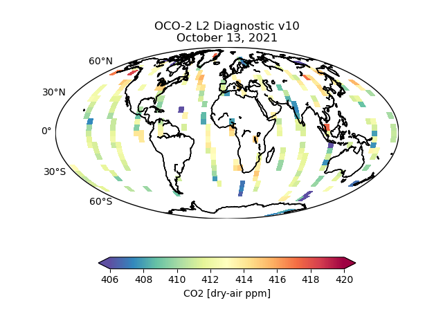
OCO-2 Level 2 geolocated XCO2 retrieval results and algorithm diagnostic information V11.2 (OCO2_L2_Diagnostic) at GES DISC
National Aeronautics and Space Administration —
Version 11.2 is the current version of the data set. Older versions will no longer be available and are superseded by Version 11.2. The Orbiting Carbon Observatory is... -
Federal
USGS Group on Earth Observations (GEO) Global Agricultural Monitoring (GLAM) Uganda
National Aeronautics and Space Administration —
The objective of GEO is to fulfil a vision of a world where decisions and actions are informed by coordinated, comprehensive and sustained Earth Observation (EO).... -
Federal
Landsat 8 Collection 1 Level-2 Scene Products (Surface Reflectance)
Department of the Interior —
The USGS Earth Resources Observation and Science (EROS) Center archive holds data collected by the Landsat suite of satellites, beginning with Landsat 1 in 1972. All... -
Federal
Field observations of ground failure triggered by the 2020 Puerto Rico earthquake sequence
Department of the Interior —
This dataset consists of over 800 field observations of ground failure (landslides, lateral spreading, and liquefaction) and other damage triggered by the 2019-2020... -
Federal
Last of the Wild Project, Version 3 (LWP-3): 2009 Human Footprint, 2018 Release
National Aeronautics and Space Administration —
The 2009 Human Footprint, 2018 Release provides a global map of the cumulative human pressure on the environment in 2009, at a spatial resolution of ~1 km. The human... -
Federal
National Assessment of Oil and Gas Project - Williston Basin Province (031) Boundary
Department of the Interior —
The USGS Central Region Energy Team assesses oil and gas resources of the United States. The onshore and State water areas of the United States comprise 71 provinces.... -
Federal
2016 Mw 6.0 Petermann Ranges earthquake, Australia: Pre- and post-earthquake digital elevation models
Department of the Interior —
We generated digital elevation models (DEMs) using pre- and post-event in-track stereo 0.5 m resolution panchromatic Worldview 1 and 2 images (©2019, DigitalGlobe)... -
Federal
AMSR-E/Aqua 5-Day L3 Global Snow Water Equivalent EASE-Grids V002
National Aeronautics and Space Administration —
These Level-3 Snow Water Equivalent (SWE) data sets contain SWE data and quality assurance flags mapped to Northern and Southern Hemisphere 25 km Equal-Area Scalable... -
Federal
2005 Environmental Sustainability Index (ESI)
National Aeronautics and Space Administration —
The 2005 Environmental Sustainability Index (ESI) is a measure of overall progress towards environmental sustainability, developed for 146 countries. The index...

Official websites use .gov
A
.gov website belongs to an official government
organization in the United States.
Secure .gov websites use HTTPS
A
lock (
) or https:// means you’ve safely connected to
the .gov website. Share sensitive information only on official,
secure websites.