

372 datasets found
-
Federal
DS-777 Spatial Location of the Model Cell Centroids for the Northern High Plains Groundwater-Flow Model in Parts of Colorado, Kansas, Nebraska, South Dakota, and Wyoming
Department of the Interior —
This data set is one of many developed in support of The High Plains Groundwater Availability Project and the U.S. Geological Survey Data Series Report: Geodatabase... -
Federal
RES2DINV Format Continuous Resistivity Profile Collected in the Neuse River, April 19, 2004
Department of the Interior —
The Neuse River Estuary in North Carolina is a broad, V-shaped water body located on the southwestern end of Pamlico Sound. This estuary suffers from severe... -
Federal
Simulated potentiometric surface contours at end of simulation (1998) in model layer 1 of the transient ground-water flow model of the Death Valley regional ground-water flow system, Nevada and California
Department of the Interior —
These contours represent the simulated potentiometric surface at the end of simulation (1998) in model layer 1 of the Death Valley regional ground-water flow system... -
Federal
Horizontal flow barriers for the transient ground-water flow model, Death Valley regional ground-water flow system, Nevada and California
Department of the Interior —
This digital dataset defines the surface traces of regional features simulated as horizontal flow barriers in the Death Valley regional ground-water flow system... -
Federal
Processed Continuous Resistivity Profiles from Cape Cod National Seashore, Feb. 28, 2006
Department of the Interior —
Continuous resistivity profiling (CRP) surveys were conducted at Cape Cod National Seashore in 2004 and 2006 in order to test hypotheses about groundwater flow under... -
Federal
DS-777 Average Annual Potential Evapotranspiration, 2000 to 2009, in inches estimated from the National Weather Service (NWS) Snow Accumulation and Ablation (SNOW-17) Model for the High Plains Aquifer in Parts of Colorado, Kansas, Nebraska, New Mexico, Oklahoma, South Dakota, Texas, and Wyoming
Department of the Interior —
The water-budget-components geodatabase contains selected data from maps in the, "Selected Approaches to Estimate Water-Budget Components of the High Plains, 1940... -
Federal
Boundary of the area contributing flow to the Death Valley regional ground-water flow system, Nevada and California
Department of the Interior —
This digital data set defines the boundary of the area contributing ground-water flow to the Death Valley regional ground-water flow-system (DVRFS) model domain. The... -
Federal
Vulnerability of shallow ground water and drinking-water wells to nitrate in the United States: Model of predicted nitrate concentration in U.S. ground water used for drinking (simulation depth 50 meters) -- Input data set for Hortonian overland flow (gwava-dw_hor)
Department of the Interior —
This data set represents infiltration excess overland flow estimated by TOPMODEL, in percent of streamflow, in the conterminous United States. The data set was used... -
Federal
Traces of geologic and hydrogeologic cross sections used to develop the hydrogeologic framework model of the Death Valley regional ground-water flow system, Nevada and California
Department of the Interior —
This digital dataset defines the traces of geologic and hydrogeologic cross sections that were used in the construction of a digital three-dimensional (3D)... -
Federal
Groundwater altitude data, from driller-measured wells, considered for the potentiometric surface, Mississippi River Valley alluvial aquifer, spring 2016
Department of the Interior —
A potentiometric surface map for spring 2016 was created for the Mississippi River Valley alluvial (MRVA) aquifer, which was referenced to the North American Vertical... -
Federal
RES2DINV Format Continuous Resistivity Profiles from Cape Cod National Seashore, Feb. 28, 2006
Department of the Interior —
Continuous resistivity profiling (CRP) surveys were conducted at Cape Cod National Seashore in 2004 and 2006 in order to test hypotheses about groundwater flow under... -
Federal
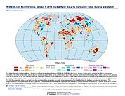
Water Security Indicator Model - Global Land Data Assimilation System (WSIM-GLDAS) Monthly Grids, Version 1
National Aeronautics and Space Administration —
The Water Security Indicator Model - Global Land Data Assimilation System (WSIM-GLDAS) Monthly Grids, Version 1 data set identifies and characterizes surpluses and... -
Federal
Processed Continuous Resistivity Profiles Collected in the Neuse River, April 21, 2004
Department of the Interior —
The Neuse River Estuary in North Carolina is a broad, V-shaped water body located on the southwestern end of Pamlico Sound. This estuary suffers from severe... -
Federal
Processed Continuous Resistivity Profiles Collected in the Neuse River, May 4, 2005
Department of the Interior —
The Neuse River Estuary in North Carolina is a broad, V-shaped water body located on the southwestern end of Pamlico Sound. This estuary suffers from severe... -
Federal
Polygons Representing Sensitivity of Ground Water to Contamination in Lawrence County, SD
Department of the Interior —
This data set includes 956 polygons labeled with a sensitivity-unit code that represents the sensitivity of ground water to contamination in Lawrence County, SD. This... -
Federal
Spring point coverage for the potentiometric coverages for the Inyan Kara, Minnekahta, Minnelusa, Madison, and Deadwood Aquifers in the Black Hills Area, South Dakota
Department of the Interior —
This dataset describes springs in the Black Hills area that were used to create potentiometric surface maps for the Inyan Kara, Minnekahta, Minnelusa, Madison, and... -
Federal
Dikes of the Lake Tahoe Basin
Department of the Interior —
These data present a ground-water inventory of existing geospatial data and other information needed to determine the extent and characteristics of the aquifers in... -
Federal
Digital data sets that describe aquifer characteristics of the alluvial and terrace deposits along the North Canadian River from Oklahoma City to Eufaula Lake in east-central Oklahoma
Department of the Interior —
This data set consists of digital polygons of a constant recharge value for the alluvial and terrace deposits along the North Canadian River from Oklahoma City to... -
Federal
Processed Continuous Resistivity Profile Collected in the Neuse River, April 19, 2004
Department of the Interior —
The Neuse River Estuary in North Carolina is a broad, V-shaped water body located on the southwestern end of Pamlico Sound. This estuary suffers from severe... -
Federal
Potmap_wells_May_June2010
Department of the Interior —
Water-level measurements of wells were taken in the Upper Floridan aquifer between the dates of May 2 and June 23, 2010. A GIS shapefile of these water-level...
372 datasets found