
-
Federal
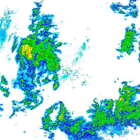
GPM GROUND VALIDATION NEXRAD LEVEL II KDVN IFLOODS V1
National Aeronautics and Space Administration —
The GPM Ground Validation Next Generation Weather Radar (NEXRAD) Level II IFloodS datasets were collected from four sites (see Table 1) from March 29, 2013 to June... -
Federal
Natural Resource Protection and Child Health Indicators, 2022 Release
National Aeronautics and Space Administration —
The Natural Resource Protection and Child Health Indicators, 2022 Release, is produced in support of the U.S. Millennium Challenge Corporation (MCC) as selection... -
Federal
High Mountain Asia GFDL FLOR Modeled Extreme Precipitation Indices V001
National Aeronautics and Space Administration —
This data set features seven standard annual mean extreme precipitation indices: Rx1day, Rx5day, CWD, R10mm, R20mm, R95pTOT, and R99pTOT. They were selected on the... -
Federal
LANDSAT SURFACE REFLECTANCE -L7 ETM+
National Aeronautics and Space Administration —
Landsat satellite data have been produced, archived, and distributed by the U.S. Geological Survey (USGS) since 1972. Users rely on these data for historical study of... -
Federal
Heat Capacity Mapping Mission Digital Source: 1978-1980
Department of the Interior —
'NASA\'s Heat Capacity Mapping Mission (HCMM) project collected Earth data in the visible and thermal bands between April 1978 and September 1980. This was an... -
Federal
TES/Aura L2 Ammonia Lite Nadir V006
National Aeronautics and Space Administration —
Atmospheric vertical profile estimates and associated errors including the mapping matrix to relate the reduced-size retrieval vectors, covariances, and averaging... -
Federal
Radiocarbon Data for Tree Ring Samples from Girdwood, Alaska
Department of the Interior —
This dataset consists of sample details and radiocarbon age data of tree-ring samples collected near Girdwood, Alaska, and analyzed at the National Ocean Sciences... -
Federal
Daily 8-Hour Maximum and Annual O3 Concentrations for the Contiguous United States, 1-km Grids, v1 (2000 - 2016)
National Aeronautics and Space Administration —
The Daily 8-Hour Maximum and Annual O3 Concentrations for the Contiguous United States, 1-km Grids, v1 (2000 - 2016) data set contains estimates of ozone... -
Federal
IRIS/Nimbus-4 Level 1 Radiance Data V001 (IRISN4RAD) at GES DISC
National Aeronautics and Space Administration —
The Nimbus-4 Infrared Interferometer Spectrometer (IRIS) Level 1 Radiance Data contain thermal emissions of the Earth's atmosphere at wave numbers between 400 and... -
Federal
Major faults in Iran (flt2cg)
Department of the Interior —
The geology data set for this map includes arcs, polygons, and labels that outline and describe the general geologic age and type of bedrock of Iran. The geologic... -
Federal
Geologic Provinces of the Arctic, 2000 (prvarcst)
Department of the Interior —
This coverage includes arcs, polygons and polygon labels that describe Arctic portion of the U.S. Geological Survey defined geologic provinces of the World in 2000. -
Federal
Las Lomas Hillside Lidar
Department of the Interior —
This data release contains point clouds obtained from three terrestrial laser scanner (TLS) surveys of a hillslope (NAD 83/11 N/ 412828E/ 3780128N) burned by the 2016... -
Federal
Natural Resource Protection and Child Health Indicators, 2023 Release
National Aeronautics and Space Administration —
The Natural Resource Protection and Child Health Indicators, 2023 Release, is produced in support of the U.S. Millennium Challenge Corporation as selection criteria... -
Federal
Slab2 - A Comprehensive Subduction Zone Geometry Model, Philippines Region
Department of the Interior —
Subduction zones are home to the most seismically active faults on the planet. The shallow megathrust interface of subduction zones host our largest earthquakes, and... -
Federal
OCO-2 Level 2 geolocated XCO2 retrievals results, physical model V11.2 (OCO2_L2_Standard) at GES DISC
National Aeronautics and Space Administration —
Version 11.2 is the current version of the data set. Older versions will no longer be available and are superseded by Version 11.2. The Orbiting Carbon Observatory is... -
Federal
Apparent Depth to the Wilcox Group, Gulf Coast (wlcxdpthg)
Department of the Interior —
The depth to top of the Wilcox Group is contoured from location and top information derived from the Petroleum Information (PI) Wells database. The depth to Wilcox... -
Federal
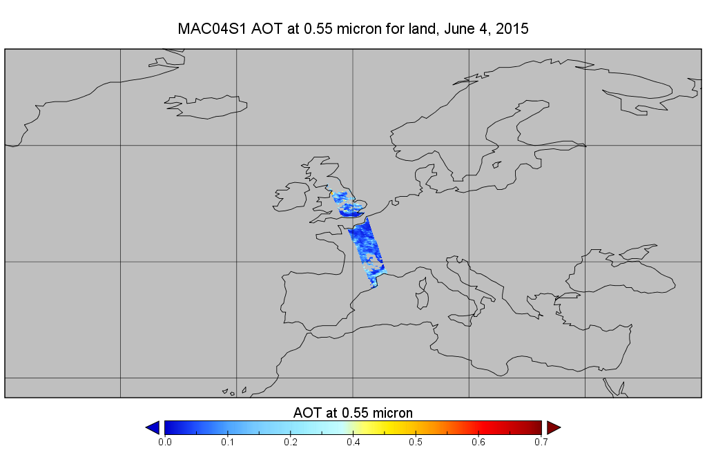
MODIS/Aqua Aerosol 10km 5-Min L2 Wide Swath Subset along CloudSat V002 (MAC04S1) at GES DISC NGDA
National Aeronautics and Space Administration —
This is the wide-swath MODIS/Aqua subset along CloudSat field of view track. The goal of the wide-swath subset is to select and return MODIS data that are within... -
Federal
OCO-3 Level 2 spatially ordered geolocated retrievals screened using the IMAP-DOAS Preprocessor (IDP), Forward Processing V10 (OCO3_L2_IMAPDOAS) at GES DISC
National Aeronautics and Space Administration —
Version 10 is the current version of the data set. Older versions will no longer be available and are superseded by Version 10. The Orbiting Carbon Observatory -3... -
Federal
OCO-2 Level 1A collated, parsed, science or calibration data, Retrospective Processing V11r (OCO2_L1aIn_Sample) at GES DISC
National Aeronautics and Space Administration —
Version 11r is the current version of the data set. Older versions will no longer be available and are superseded by Version 11r. The Orbiting Carbon Observatory is...

Official websites use .gov
A
.gov website belongs to an official government
organization in the United States.
Secure .gov websites use HTTPS
A
lock (
) or https:// means you’ve safely connected to
the .gov website. Share sensitive information only on official,
secure websites.