

189 datasets found
-
Federal
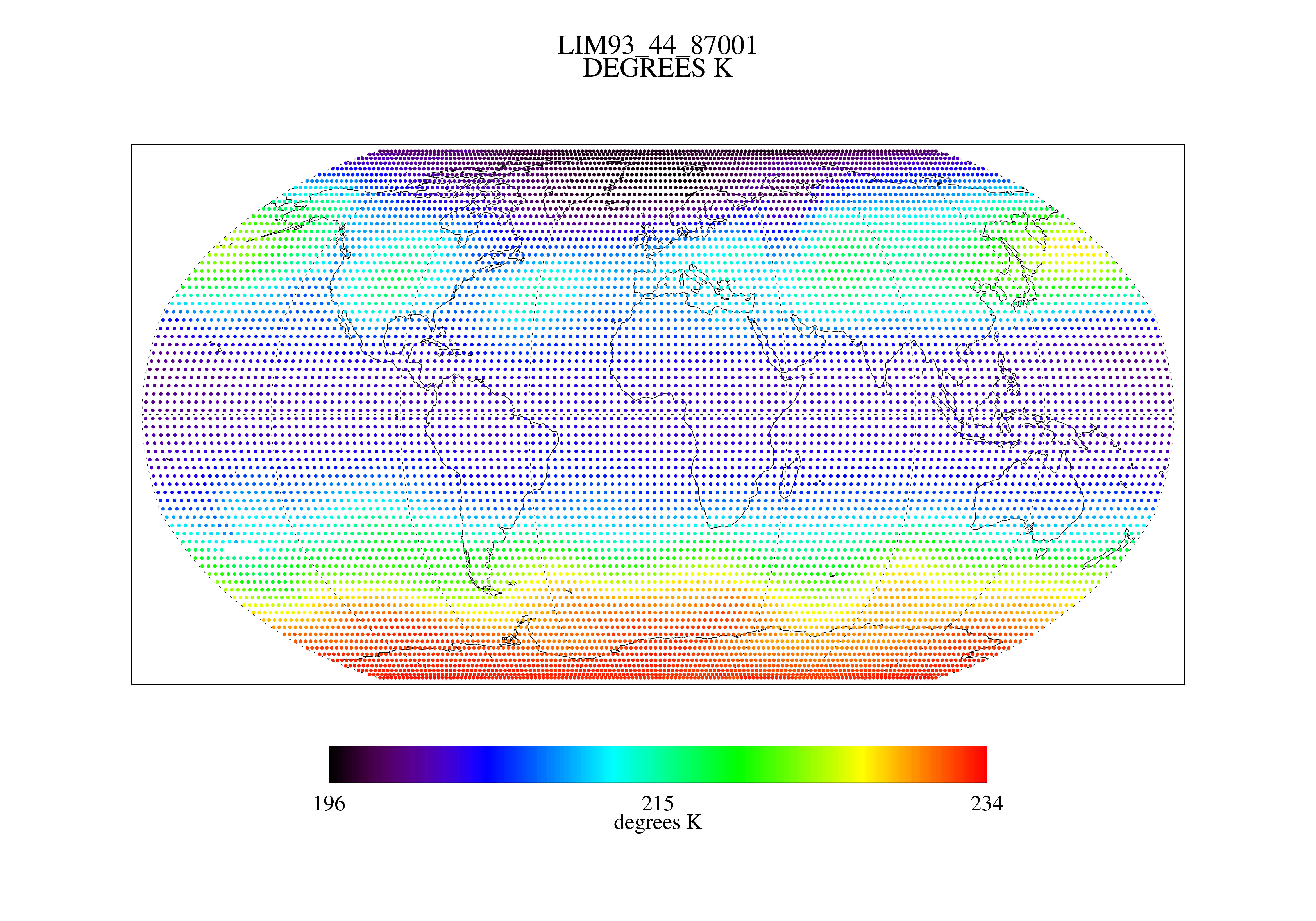
MSU Ch 4 Daily Lower Stratosphere Temps with Limb93 Correction L3 1 day 2.5 degree x 2.5 degree V001 (MSULST) at GES DISC
National Aeronautics and Space Administration —
The Microwave Sounding Unit (MSU) Lower Stratosphere Deep Layer Mean Temperature product (MSULST) provides gridded lower stratospheric temperatures for each day... -
Federal
TROPICS06 L2B Neural-network Atmospheric Vertical Temperature & Moisture Profiles V1.0
National Aeronautics and Space Administration —
The "Time-Resolved Observations of Precipitation structure and storm Intensity with a Constellation of Smallsats" (TROPICS) mission has a goal of providing nearly... -
Federal
NOAA Climate Data Record (CDR) of SSMI(S) and AMSR2 Microwave Brightness Temperatures, CSU Version 2
National Oceanic and Atmospheric Administration, Department of Commerce —
This NOAA Fundamental Climate Data Record (FCDR) from Colorado State University (CSU) contains brightness temperatures that have been improved and quality-controlled... -
Federal
NOAA Climate Data Record (CDR) of MSU Level 1c Brightness Temperature, Version 1.0
National Oceanic and Atmospheric Administration, Department of Commerce —
This dataset contains Level 1c inter-calibrated brightness temperatures from the Microwave Sounding Unit (MSU) sensors onboard nine polar orbiting satellites... -
Federal
Pathfinder Climate Data
National Oceanic and Atmospheric Administration, Department of Commerce —
The NOAA/NASA Pathfinder climate data CD-ROM contains seven data sets: Advanced Very High Resolution Radiometer (AVHRR)Land and Ocean, TIROS Operational Vertical... -
Federal
Aquarius L3 Weekly Polar-Gridded Brightness Temperature and Sea Surface Salinity V005
National Aeronautics and Space Administration —
The data set consists of weekly gridded Level-3 products of Aquarius L-band radiometer brightness temperature (TB) observations and Sea Surface Salinity (SSS)... -
Federal
AMSR/ADEOS-II L2A Global Swath Spatially-Resampled Brightness Temperatures V001
National Aeronautics and Space Administration —
The AMSR Level-2A product (AA_L2A) contains brightness temperatures at 6.9 GHz, 10.65 GHz, 18.7 GHz, 23.8 GHz, 36.5 GHz, 89.0 GHz, 50.3 GHz, and 52.8GHz. Data are... -
Federal
SWOT Level 2 Radiometer Brightness Temperatures and Troposphere Operational Data Product, Version 2.0
National Aeronautics and Space Administration —
The SWOT Level 2 Radiometer Brightness Temperatures and Troposphere Operational Geophysical Data Record (OGDR) Version 1.0 dataset produced by the Surface Water and... -
Federal
Hurricane Satellite (HURSAT) Microwave (MW)
National Oceanic and Atmospheric Administration, Department of Commerce —
The Hurricane Satellite (HURSAT) from Microwave (MW) observations of tropical cyclones worldwide data consist of raw satellite observations. The data derive from the...
189 datasets found