
-
Federal
Near-road ultrafine particle and carbon monoxide measurements at North Carolina locations with and without roadside barriers
U.S. Environmental Protection Agency —
These data are measurement time series collected onboard multiple mobile monitoring vehicles. The data are at a high time resolution (seconds to minutes). This... -
Federal
Air Quality System (AQS)
U.S. Environmental Protection Agency —
The Air Quality System (AQS) database contains measurements of air pollutant concentrations from throughout the United States and its territories. The measurements... -
Federal
Associations between environmental quality and infant mortality in the United States, 2000-2005
U.S. Environmental Protection Agency —
Infant mortality was defined as death before completion of first year of life [1]. We obtained linked birth and infant death data from the U.S. Centers for Disease... -
Federal
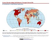
Country Trends in Major Air Pollutants
National Aeronautics and Space Administration —
The Country Trends in Major Air Pollutants data set is a framework of public-health-focused air quality indicators that quantifies over 200 countries' trends in... -
Federal
Dataset for Ngo et al. (2024), "Bridging Existing Energy and Chemical Transport Models to Enhance Air Quality Policy Assessment"
U.S. Environmental Protection Agency —
This file describes the dataset used in the following article: Ngo, S., B.N. Murphy, C.G. Nolte, K.E. Brown (2024), Bridging existing energy and chemical transport... -
Federal
Photooxidation of farnesene mixtures in the presence of NOx: Analysis of reaction products and their implication to ambient PM2.5
U.S. Environmental Protection Agency —
Chemical analysis of SOA produced from the irradiation of a mixture of α/β-farnesene/NOx was conducted in a 14.5 cubic meter smog chamber. SOA collected on glass-... -
Federal
National Atmospheric Deposition Program: AMNet Site AK03, Denali National Park and Preserve
Department of the Interior —
General Info Site IDAK03 Site NameDenali National Park-Mt. McKinley CountyDenali State/Prov.AK Start Date03/10/2014 Stop Date StatusA Latitude63.7232... -
Federal
Data from "Air pollution control strategies directly limiting national health damages in the US", by Ou et al.
U.S. Environmental Protection Agency —
This file describes the dataset used in Ou et al., "Air pollution control strategies directly limiting national health damages in the US." This work used the Global... -
Federal
Regional Air Quality Data
U.S. Environmental Protection Agency —
This asset provides data on regional air quality, including trace level SO2, nitric acid, ozone, carbon monoxide, and NOy; and particulate sulfate, nitrate, and... -
Federal
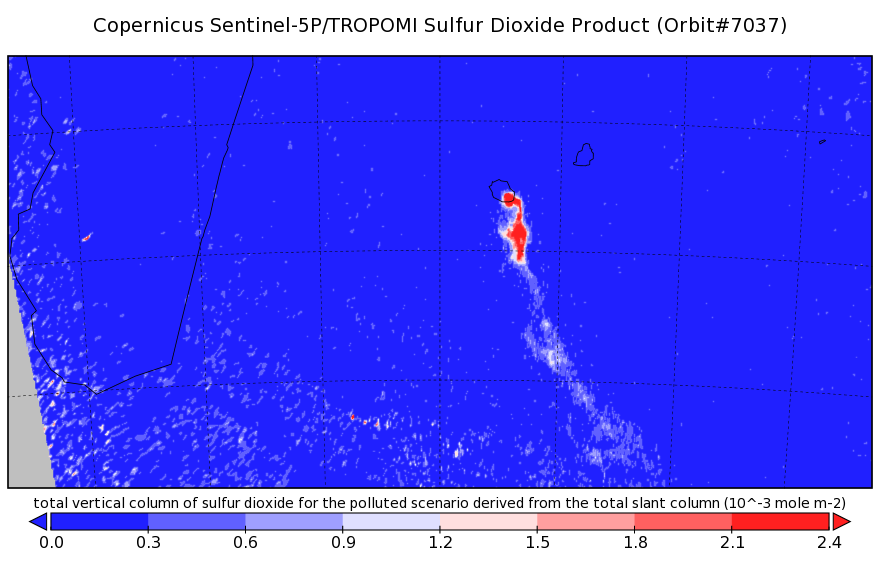
Sentinel-5P TROPOMI Near-Real-Time (NRT) Sulphur Dioxide SO2 1-Orbit L2 5.5km x 3.5km V2 (S5P_L2__SO2____HiR_NRT) at GES DISC
National Aeronautics and Space Administration —
The Sentinel-5P TROPOMI Near Real Time (NRT) Sulphur Dioxide SO2 1-Orbit L2 5.5km x 3.5km V2 (S5P_L2__SO2_HiRNRT) at GES DISC is the near real time... -
City
Local Air Quality CHPL 211297
Town of Chapel Hill, North Carolina —
This dataset contains air quality data collected using a PurpleAir Dual Laser Air Quality Sensor located at the Chapel Hill Public Library. -
Federal
Sentinel-5P TROPOMI Sulphur Dioxide SO2 1-Orbit L2 7km x 3.5km V1 (S5P_L2__SO2___) at GES DISC
National Aeronautics and Space Administration —
Starting from August 6th in 2019, Sentinel-5P TROPOMI along-track high spatial resolution (~5.5km at nadir) has been implemented. Starting from July 13th in 2020,... -
Federal
Long Term RadNet Quality Data
U.S. Environmental Protection Agency —
This RadNet Quality Data Asset includes all data since initiation and when ERAMS was expanded to become RadNet, name changed to reflect new mission. This includes the... -
Federal
Raw data from "Uncertainty in collocated mobile measurements of air quality" version 1.1, updated 2020-04-13
U.S. Environmental Protection Agency —
This is the raw pollutant data collected on August 6, 2014 in the greater Denver, Colorado area by three mobile air pollution platforms. Data was collected by Aclima,... -
State
Maryland Ozone Exceedance Days in 2011
State of Maryland —
Maryland 8-Hour Ozone Concentrations Exceeding 2008 Health-Based Standard in ppb, Finalized Data. In 2008 EPA set the ozone standard to 75 ppb. High levels of ozone... -
Federal
Phoenix Study
U.S. Environmental Protection Agency —
Phoenix Traffic and Mobile Data. This dataset is associated with the following publication: Baldauf , R., V. Isakov , P. Deshmukh, and A. Venkatram. Influence of... -
Federal
TES/Aura L2 Methanol Nadir V007
National Aeronautics and Space Administration —
TL2MTLN_7 is the Tropospheric Emission Spectrometer (TES)/Aura Level 2 Methanol Nadir Version 7 data product. TES was an instrument aboard NASA's Aura satellite and... -
Federal
NASA Scientific Visualization Studio Galleries
National Aeronautics and Space Administration —
The Scientific Visualization Studio hosts a collection of media galleries on Earth, air, and space themes. -
County
Allegheny County Particulate Matter 2.5
Allegheny County / City of Pittsburgh / Western PA Regional Data Center —
The U.S. Environmental Protection Agency provides information on the particulate matter concentration for Allegheny County that have a diameter greater or equal to...

Official websites use .gov
A
.gov website belongs to an official government
organization in the United States.
Secure .gov websites use HTTPS
A
lock (
) or https:// means you’ve safely connected to
the .gov website. Share sensitive information only on official,
secure websites.