


9 datasets found
-
Federal
COWVR STP-H8 Surface Wind Vector and Column-Integrated Atmospheric Water Measurements Version 10.0
National Aeronautics and Space Administration —
This dataset includes satellite-based observations of geolocated surface wind vectors, precipitable water vapor, and integrated cloud liquid water, as well as the... -
Federal
GHRSST Level 4 MUR Global Foundation Sea Surface Temperature Analysis (v4.1)
National Aeronautics and Space Administration —
A Group for High Resolution Sea Surface Temperature (GHRSST) Level 4 sea surface temperature analysis produced as a retrospective dataset (four day latency) and near-... -
Federal
OPERA Dynamic Surface Water Extent from Harmonized Landsat Sentinel-2 product (Version 1)
National Aeronautics and Space Administration —
This dataset contains Level-3 Dynamic OPERA surface water extent product version 1. The data are validated surface water extent observations beginning April 2023.... -
Federal
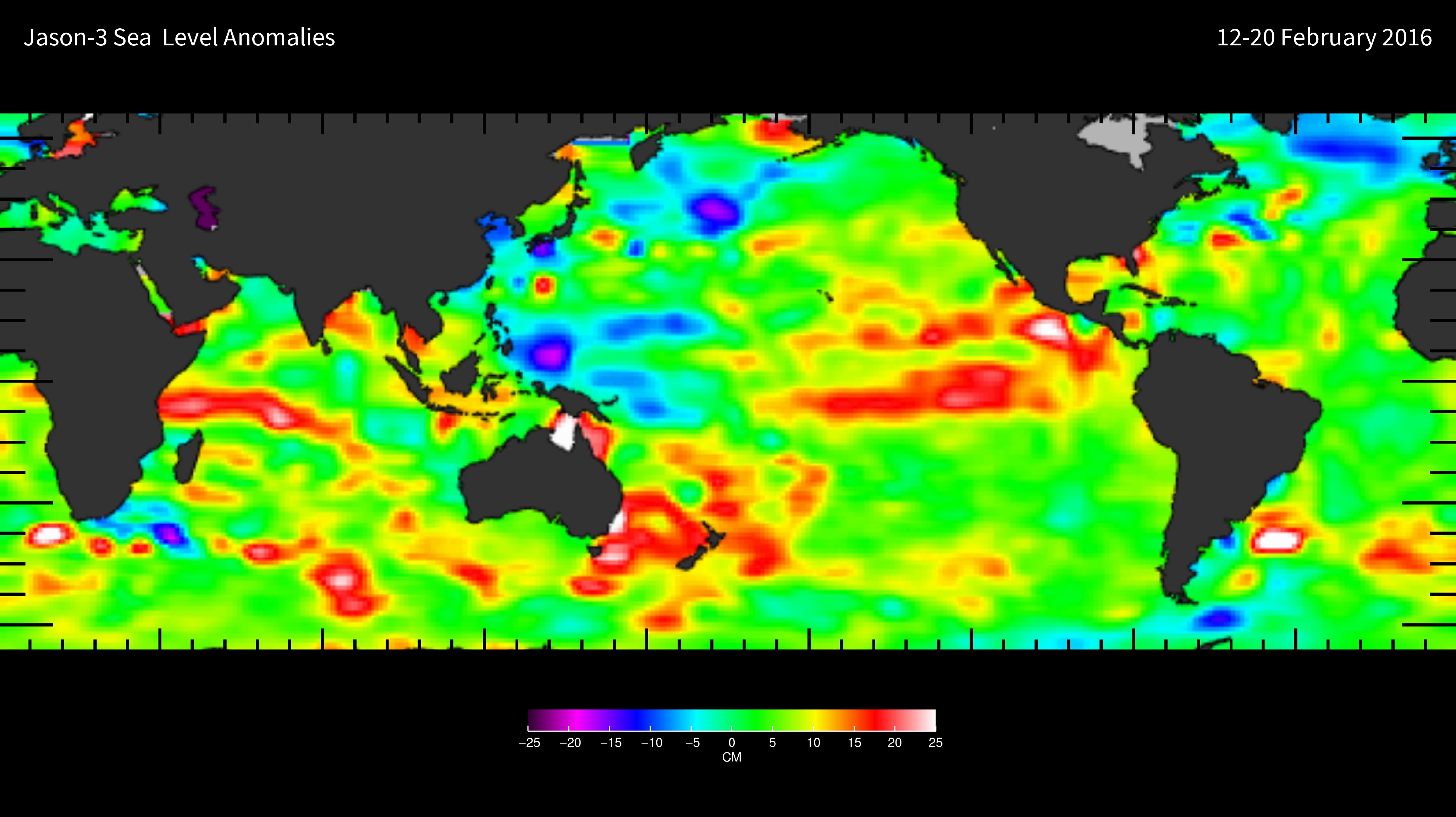
Jason-3 Wet Path Delay Correction
National Aeronautics and Space Administration —
This dataset provides supplementary wet tropospheric corrections for historical Jason-3 observations (https://www.ncei.noaa.gov/archive/accession/Jason3-xGDR). Recent... -
Federal
OPERA Dynamic Surface Water Extent from Sentinel-1 (Version 1)
National Aeronautics and Space Administration —
This dataset contains Level-3 Dynamic OPERA Surface Water Extent from Sentinel-1 (DSWx-S1) product version 1. DSWx-S1 provides near-global geographical mapping of... -
Federal
COWVR STP-H8 Antenna and Microwave Brightness Temperatures Version 10.0
National Aeronautics and Space Administration —
This data set includes satellite-based observations of calibrated, geo-located antenna temperature and brightness temperatures, along with the sensor telemetry used... -
Federal
TEMPEST STP-H8 Antenna and Microwave Brightness Temperatures Version 10.0
National Aeronautics and Space Administration —
This dataset includes satellite-based observations of calibrated, geo-located antenna temperature and brightness temperatures, along with the sensor telemetry used to... -
Federal
GHRSST Level 4 MUR 0.25deg Global Foundation Sea Surface Temperature Analysis (v4.2)
National Aeronautics and Space Administration —
A Group for High Resolution Sea Surface Temperature (GHRSST) Level 4 sea surface temperature analysis produced as a retrospective dataset at the JPL Physical... -
Federal
OPERA Dynamic Surface Water Extent from Sentinel-1 CalVal Database (Version 1)
National Aeronautics and Space Administration —
This dataset contains the calibration/validation (CalVal) database for the OPERA DSWx-S1 product. The CalVal database is a zip file of an Amazon Web Services S3...
9 datasets found