-
Federal
Critical Facilities for Coastal Geographies
National Oceanic and Atmospheric Administration, Department of Commerce —
The critical facilities data are derived from the USGS Structures Inventory Database (June, 2016). The structures in the derived dataset displays aggregated totals of... -
Federal
EnviroAtlas - Domestic Water Demand by 12-Digit HUC for the Conterminous United States
U.S. Environmental Protection Agency —
This EnviroAtlas dataset includes domestic water demand attributes which provide insight into the amount of water currently used for indoor and outdoor residential... -
Federal
Waterway Locks NGDA
Department of Transportation —
The Waterway Locks dataset is periodically updated by the United States Army Corp of Engineers (USACE) and is part of the U.S. Department of Transportation... -
Federal
Meteorological and oceanographic data collected from the National Data Buoy Center Coastal-Marine Automated Network (C-MAN) and moored (weather) buoys
National Oceanic and Atmospheric Administration, Department of Commerce —
The National Data Buoy Center (NDBC) established the Coastal-Marine Automated Network (C-MAN) for the National Weather Service in the early 1980's. NDBC has installed... -
Federal
ICLUS v1.3 Housing Density for the Conterminous USA
U.S. Environmental Protection Agency —
Climate and land-use change are major components of global environmental change with feedbacks between these components. The consequences of these interactions show... -
Federal
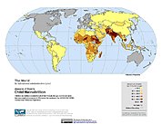
Poverty Mapping Project: Global Subnational Prevalence of Child Malnutrition
National Aeronautics and Space Administration —
The Poverty Mapping Project: Global Subnational Prevalence of Child Malnutrition data set consists of estimates of the percentage of children with weight-for-age... -
Federal
IceBridge DMS L1B Geolocated and Orthorectified Images V001
National Aeronautics and Space Administration —
This data set contains Level-1B imagery taken from the Digital Mapping System (DMS) over Greenland and Antarctica. The data were collected as part of Operation... -
Federal
Global Reservoir and Dam Database, Version 1 (GRanDv1): Dams, Revision 01
National Aeronautics and Space Administration —
The Global Reservoir and Dam Database, Version 1, Revision 01 (v1.01) contains 6,862 records of reservoirs and their associated dams with a cumulative storage... -
Federal
Coastal Zone Management Act Boundary
National Oceanic and Atmospheric Administration, Department of Commerce —
These data represent the extent of the nation's coastal zone, as defined by the individual states and territories under the Coastal Zone Management Act of 1972... -
Federal
MODIS/Aqua Sea Ice Extent Daily L3 Global 1km EASE-Grid Day V061 NGDA
National Aeronautics and Space Administration —
This global Level-3 (L3) data set provides daily daytime sea ice extent and ice surface temperature derived from the 'MODIS/Aqua Sea Ice Extent 5-Min L2 Swath 1km'... -
Federal
TIGER/Line Shapefile, 2018, nation, U.S., Current American Indian/Alaska Native/Native Hawaiian Areas National (AIANNH) National
U.S. Census Bureau, Department of Commerce —
The TIGER/Line Shapefiles and related database files (.dbf) are an extract of selected geographic and cartographic information from the U.S. Census Bureau's Master... -
Federal
Sensitivity of Coastal Environments and Wildlife to Spilled Oil: Northwest Arctic, Alaska: NESTS (Nest Points)
National Oceanic and Atmospheric Administration, Department of Commerce —
This data set contains sensitive biological resource data for nesting birds in Northwest Arctic, Alaska. Vector points in this data set represent locations of nesting... -
Federal
Sea Ice Concentrations from Nimbus-7 SMMR and DMSP SSM/I-SSMIS Passive Microwave Data V002
National Aeronautics and Space Administration —
This data set is generated from brightness temperature data and is designed to provide a consistent time series of sea ice concentrations spanning the coverage of... -
Federal
Coastal Change Analysis Program (C-CAP) Regional Land Cover Data and Change Data NGDA
National Oceanic and Atmospheric Administration, Department of Commerce —
The NOAA Coastal Change Analysis Program (C-CAP) produces national standardized land cover and change products for the coastal regions of the U.S. C-CAP products... -
Federal
EnviroAtlas - Percent Urban Land Cover by 12-Digit HUC for the Conterminous United States
U.S. Environmental Protection Agency —
This EnviroAtlas dataset estimates the percent urban land for each 12-digit hydrologic unit code (HUC) in the conterminous United States. For the purposes of this... -
Federal
MEaSUREs Global Record of Daily Landscape Freeze/Thaw Status V005
National Aeronautics and Space Administration —
This data set, part of the NASA Making Earth System Data Records for Use in Research Environments (MEaSUREs) program, contains a global record of the daily... -
Federal
EnviroAtlas - Average Annual Precipitation 1981-2010 by HUC12 for the Conterminous United States
U.S. Environmental Protection Agency —
This EnviroAtlas dataset provides the average annual precipitation by 12-digit Hydrologic Unit (HUC). The values were estimated from maps produced by the PRISM... -
Federal
EnviroAtlas - Atmospheric Nitrogen and Sulfur Deposition by 12-digit HUC for the Conterminous United States (2017)
U.S. Environmental Protection Agency —
This EnviroAtlas dataset includes annual nitrogen and sulfur deposition within each 12-digit HUC subwatershed for the year 2017. Values are provided for total... -
Federal
EPA Tribes (2 of 6): Alaska Native Villages
U.S. Environmental Protection Agency —
This layer represents center points of Alaska Native Villages. The Alaska Native Villages are associated with Federally recognized tribal entities. -
Federal
NWHI Essential Fish Habitat Boundaries
National Oceanic and Atmospheric Administration, Department of Commerce —
Essential Fish Habitat depth polygon.

Official websites use .gov
A
.gov website belongs to an official government
organization in the United States.
Secure .gov websites use HTTPS
A
lock (
) or https:// means you’ve safely connected to
the .gov website. Share sensitive information only on official,
secure websites.