-
Federal
Shuttle Radar Topography Mission DTED Level 1 (3-arc second) Data (DTED-1)
National Aeronautics and Space Administration —
The Shuttle Radar Topography Mission (SRTM) successfully collected Interferometric Synthetic Aperture Radar (IFSAR) data over 80 percent of the landmass of the Earth... -
Federal
Shuttle Radar Topography Mission 1-arc second Global
National Aeronautics and Space Administration —
The Shuttle Radar Topography Mission (SRTM) was flown aboard the space shuttle Endeavour February 11-22, 2000. The National Aeronautics and Space Administration... -
Federal
Shuttle Radar Topography Mission (SRTM) Version 2
National Aeronautics and Space Administration —
NASA has released version 2 of the Shuttle Radar Topography Mission digital topographic data (also known as the "finished" version). Version 2 is the result of a... -
Federal
Shuttle Radar Topography Mission (SRTM) Images
National Aeronautics and Space Administration —
Culminating more than four years of processing data, NASA and the National Geospatial-Intelligence Agency (NGA) have completed Earth's most extensive global... -
Federal
SnowEx17 SnowSAR Raw FMCW Waveforms V001
National Aeronautics and Space Administration —
This data set, part of the SnowEx 2017 campaign, contains raw data captured from the SnowSAR instrument. The processed SnowSAR data are also archived at NSIDC (DOI:... -
Federal
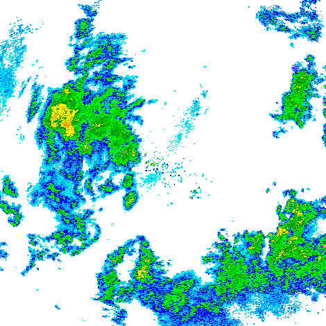
GPM Ground Validation Doppler on Wheels (DOW) OLYMPEX V2
National Aeronautics and Space Administration —
The GPM Ground Validation Doppler on Wheels (DOW) OLYMPEX V2 dataset was obtained by a dual-polarization and dual-frequency X-band mobile radar operated by the Center... -
Federal
GPM GROUND VALIDATION NEXRAD LEVEL II KDVN IFLOODS V1
National Aeronautics and Space Administration —
The GPM Ground Validation Next Generation Weather Radar (NEXRAD) Level II IFloodS datasets were collected from four sites (see Table 1) from March 29, 2013 to June... -
Federal
Global Sentinel-1 Burst ID Map
National Aeronautics and Space Administration —
Sentinel-1 performs systematic acquisition of bursts in both IW and EW modes. The bursts overlap almost perfectly between different passes and are always located at... -
Federal
Monthly snow/ice averages (ISCCP)
National Aeronautics and Space Administration —
September Arctic sea ice is now declining at a rate of 11.5 percent per decade, relative to the 1979 to 2000 average. Data from NASA show that the land ice sheets in... -
Federal
SMAP_L1A_RADAR_RECEIVE_ONLY_METADATA_V001
National Aeronautics and Space Administration —
SMAP Level 1A Radar Receive Only Product Metadata Version 1 -
Federal
IceBridge Ku-Band Radar L1B Geolocated Radar Echo Strength Profiles V002
National Aeronautics and Space Administration —
This data set contains elevation and surface measurements over Greenland, the Arctic, and Antarctica, as well as flight path charts and echogram images acquired using... -
Federal
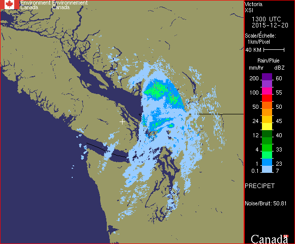
GPM Ground Validation CXSI Radar Imagery OLYMPEX V1
National Aeronautics and Space Administration —
The GPM Ground Validation CXSI Radar Imagery OLYMPEX dataset contains radar reflectivity and precipitation rate images obtained from Environment and Climate Change... -
Federal
SMAP Radar Twice-Daily SAR and SIR-Enhanced Scatterometer EASE-Grid 2.0 Radar Backscatter V001
National Aeronautics and Space Administration —
This data set contains twice-daily synthetic aperture radar (SAR) and enhanced-resolution scatterometer radar backscatter derived from SMAP radar data. Data are... -
Federal
PDS Cassini Data Release 5
National Aeronautics and Space Administration —
CDA, CIRS, RADAR, SPICE, UVIS -
Federal
IceBridge MCoRDS L1B Geolocated Radar Echo Strength Profiles V002
National Aeronautics and Space Administration —
This data set contains radar echograms taken from the Center for Remote Sensing of Ice Sheets (CReSIS) ultra Multichannel Coherent Radar Depth Sounder (MCoRDS) over... -
Federal
SMAP L3 Radar Global Daily 3 km EASE-Grid Soil Moisture V003
National Aeronautics and Space Administration —
This Level-3 (L3) soil moisture product provides a composite of daily estimates of global land surface conditions retrieved by the Soil Moisture Active Passive (SMAP)... -
Federal
SWOT Level 1B High-Rate Single-look Complex Data Product, Version 2.0
National Aeronautics and Space Administration —
High rate data processed to single-look complex SAR images for each antenna. Gridded tile (approx 64x64 km2); half swath (left or right side of full swath). Available... -
Federal
SnowEx20 Grand Mesa IOP BSU Multi-polarization 1 GHz GPR CMP Raw V001
National Aeronautics and Space Administration —
This data set was collected during the SnowEx 2020 Intensive Observation Period (IOP) in Grand Mesa, Colorado. These data contain the geolocated, unprocessed, common... -
Federal
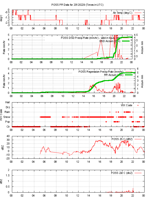
GPM GROUND VALIDATION ENVIRONMENT CANADA (EC) PRECIPITATION OCCURRENCE SENSOR SYSTEM (POSS) GCPEX V1
National Aeronautics and Space Administration —
The GPM Ground Validation Environment Canada (EC) Precipitation Occurrence Sensor System (POSS) GCPEx dataset is comprised of data gathered during the GPM Cold-season... -
Federal
Side Looking Airborne Radar (SLAR) Imagery
National Aeronautics and Space Administration —
Side-Looking Airborne Radar (SLAR) imagery is available from the U.S. Geological Survey (USGS) for selected project areas in the conterminous United States and...

Official websites use .gov
A
.gov website belongs to an official government
organization in the United States.
Secure .gov websites use HTTPS
A
lock (
) or https:// means you’ve safely connected to
the .gov website. Share sensitive information only on official,
secure websites.