
-
Federal
Aqua/AIRS L3 Daily Support Product (AIRS-only) 1 degree x 1 degree V7.0 at GES DISC
National Aeronautics and Space Administration —
The Atmospheric Infrared Sounder (AIRS) is a grating spectrometer (R = 1200) aboard the second Earth Observing System (EOS) polar-orbiting platform, EOS Aqua. In... -
Federal
AMSR-E/Aqua surface soil moisture (LSMEM) L3 1 day 0.25 degree x 0.25 degree V001 (WC_LSMEM_SOILM_025) at GES DISC
National Aeronautics and Space Administration —
AMSR-E/Aqua surface soil moisture (LSMEM) L3 1 day 0.25 degree x 0.25 degree V001 is a global, 10-year (2002-2011) data set. It is created from soil moisture... -
Federal
VIIRS/NPP BRDF/Albedo Valid Observation Band M10 Daily L3 Global 30ArcSec CMG V002
National Aeronautics and Space Administration —
The NASA/NOAA Suomi National Polar-orbiting Partnership (Suomi NPP) Visible Infrared Imaging Radiometer Suite (VIIRS) Bidirectional Reflectance Distribution Function... -
Federal
VISSR/GOES-3 Visible Imagery on 70mm Film V001 (VISSRGOES3IMVIS) at GES DISC
National Aeronautics and Space Administration —
VISSRGOES3IMVIS is the Visible Infrared Spin-Scan Radiometer (VISSR) Visible Imagery on 70mm Film data product from the third Geostationary Operational Environmental... -
Federal
TROPESS Chemical Reanalysis Surface SO2 2-Hourly 2-dimensional Product V1 (TRPSCRSO22H2D) at GES DISC
National Aeronautics and Space Administration —
The TROPESS Chemical Reanalysis SO2 2-Hourly 2-dimensional Product contains surface concentrations of sulfur dioxide. The data are part of the Tropospheric Chemical... -
Federal
TROPESS Chemical Reanalysis Surface NO2 2-Hourly 2-dimensional Product V1 (TRPSCRNO22H2D) at GES DISC
National Aeronautics and Space Administration —
The TROPESS Chemical Reanalysis NO2 2-Hourly 2-dimensional Product contains surface concentrations of nitrogen dioxide. The data are part of the Tropospheric Chemical... -
Federal
TROPESS Chemical Reanalysis Surface NO 2-Hourly 2-dimensional Product V1 (TRPSCRNO2H2D) at GES DISC
National Aeronautics and Space Administration —
The TROPESS Chemical Reanalysis NO 2-Hourly 2-dimensional Product contains surface concentrations of nitric oxide. The data are part of the Tropospheric Chemical... -
Federal
VIIRS/NPP Vegetation Indices Monthly L3 Global 0.05Deg CMG V001
National Aeronautics and Space Administration —
The VNP13C2 VIIRS Version 1 data product was decommissioned on April 8th, 2025. Users are encouraged to use Version 2 data products, which provideFederalVIIRS/NPP BRDF/Albedo Parameter 3 NIR Daily L3 Global 30 ArcSec CMG V002
National Aeronautics and Space Administration —
The NASA/NOAA Suomi National Polar-orbiting Partnership (Suomi NPP) Visible Infrared Imaging Radiometer Suite (VIIRS) Bidirectional Reflectance Distribution Function...FederalSMEX04 Site Photographs, Arizona, Version 1
National Aeronautics and Space Administration —
Notice to Data Users: The documentation for this data set was provided solely by the Principal Investigator(s) and was not further developed, thoroughly reviewed, or...FederalVIIRS/NPP Moderate Resolution Terrain-Corrected Geolocation L1 6-Min Swath 750 m
National Aeronautics and Space Administration —
The VIIRS/NPP Moderate Resolution Terrain-Corrected Geolocation 6-Min L1 Swath 750 m product, short-name VNP03MOD, contains the derived line-of-sight (LOS) vectors...FederalSAFARI 2000 Organic Soil Carbon and Nitrogen Data (Zinke et al.)
National Aeronautics and Space Administration —
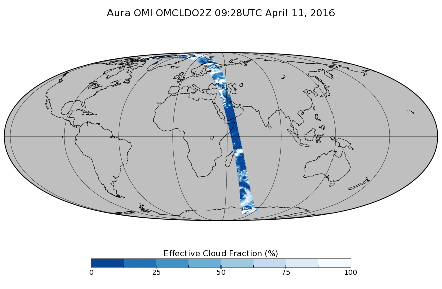
The data set contains a subset of the Worldwide Organic Soil Carbon and Nitrogen (Zinke et al. 1986) data set for southern Africa. The data were obtained from soil...FederalOMI/Aura Cloud Pressure and Fraction (O2-O2 Absorption) Zoomed 1-Orbit L2 Swath 13x12km V003 (OMCLDO2Z) at GES DISC
National Aeronautics and Space Administration —
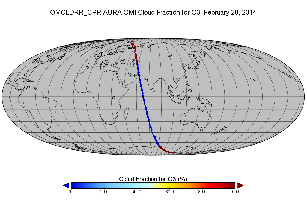
The reprocessed Aura Ozone Monitoring Instrument (OMI) Level-2 zoomed cloud data product OMCLDO2Z at 13x12 km resolution is now available from the NASA Goddard Earth...FederalOMI/Aura Cloud Pressure and Fraction (Raman Scattering) 200-km swath subset along CloudSat track V003 (OMCLDRR_CPR) at GES DISC
National Aeronautics and Space Administration —
This is the OMI/Aura Cloud Pressure and Fraction (Raman Scattering) subset along CloudSat tracks, for the purposes of the A-Train mission. The original data product...FederalOMPS-NPP L2 NM Nitrogen Dioxide (NO2) Total and Tropospheric Column swath orbital V2 (OMPS_NPP_NMNO2_L2) at GES DISC
National Aeronautics and Space Administration —
The OMPS-NPP L2 NM Nitrogen Dioxide (NO2) Total and Tropospheric Column swath orbital collection 2 version 2.0 product contains the retrieved nitrogen dioxide (NO2)...FederalOMPS-N20 NM PCA SO2 Step 1 Total Column 1-Orbit L2 Swath 17x13km NRT
National Aeronautics and Space Administration —
The OMPS-N20 NM PCA SO2 Step1 Total Column 1-Orbit L2 Swath 17x13km collection 1 product contains the retrieved sulfur dioxide (SO2) measured by the Ozone Mapping and...FederalOMI/Aura Level 1B UV Zoom-in Geolocated Earthshine Radiances V004 (OML1BRUZ) at GES DISC
National Aeronautics and Space Administration —
The Aura Ozone Monitoring Instrument (OMI) Level 1B (L1B) Geolocated Earthshine UV Radiance, Zoom-mode (shortname OML1BRUZ) Version 4 product contains geolocated...FederalSounder SIPS: JPSS-1 CrIS Level 3 Comprehensive Quality Control Gridded Monthly CLIMCAPS V2 (SNDRJ1IML3CMCCP) at GES DISC
National Aeronautics and Space Administration —
WARNING: To users of the derived product “co_mmr_midtrop” (carbon monoxide mass mixing ratio to dry air [kg/kg] at ~500 hPa). This variable has a significant bias due...FederalSMEX03 Landsat Thematic Mapper Imagery: Georgia, Version 1
National Aeronautics and Space Administration —
This data set provides imagery developed from Landsat 5 Thematic Mapper (TM) data for use in studying land cover features during the Soil Moisture Experiment 2003...FederalOMI/Aura Aerosol product Multi-wavelength Algorithm Zoomed 1-Orbit L2 Swath 13x12km V003 (OMAEROZ) at GES DISC
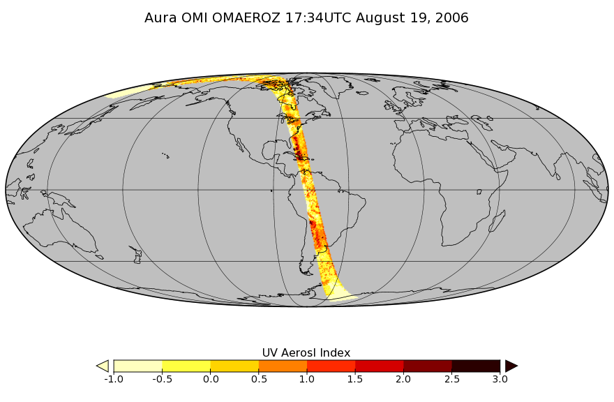
National Aeronautics and Space Administration —
The reprocessed OMI/Aura Level-2 Zoomed Aerosol data product OMAEROZ at 13x12 km resolution have been made available from the NASA Goddard Earth Sciences Data and...12,246 datasets found

Official websites use .gov
A
.gov website belongs to an official government
organization in the United States.
Secure .gov websites use HTTPS
A
lock (
) or https:// means you’ve safely connected to
the .gov website. Share sensitive information only on official,
secure websites.