
-
Federal
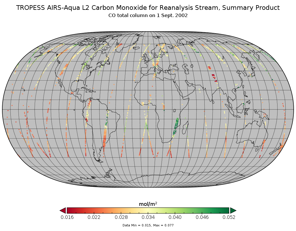
TROPESS AIRS-Aqua L2 Carbon Monoxide for Reanalysis Stream, Summary Product V1 (TRPSYL2COAIRSORS) at GES DISC
National Aeronautics and Space Administration —
The TROPESS AIRS-Aqua L2 Carbon Monoxide for Reanalysis Stream, Summary Product contains the vertical distribution of the retrieved atmospheric state of carbon... -
Federal
VIIRS/JPSS1 BRDF/Albedo Uncertainty Daily L3 Global 30ArcSec CMG V002
National Aeronautics and Space Administration —
The NOAA-20 Visible Infrared Imaging Radiometer Suite (VIIRS) Bidirectional Reflectance Distribution Function (BRDF) and Albedo Uncertainty product (VJ143D53) is... -
Federal
PEM West A Ground Data
National Aeronautics and Space Administration —
PEM-West-A_Ground_Data is the ground site data collected during the Pacific Exploratory Mission (PEM) West A suborbital campaign. Data utilizing the Nondispersive... -
Federal
SatCORPS CERES GEO Edition 4 GOES-16 Southern Hemisphere Version 1.4
National Aeronautics and Space Administration —
CER_GEO_Ed4_GOE16_SH_V01.4 is the Satellite Cloud and Radiation Property retrieval System (SatCORPS) Clouds and the Earth's Radiant Energy System (CERES)... -
Federal
Transcription profiling of human peripheral blood to development gene expression signatures for practical radiation biodosimetry
National Aeronautics and Space Administration —
To further development of our gene expression approach to biodosimetry we have employed whole genome microarray expression profiling as a discovery platform to... -
Federal
CAMEX-4 ER-2 NAVIGATION DATA V1
National Aeronautics and Space Administration —
The CAMEX-4 ER-2 Navigation data files contain information recorded by on board navigation and data collection systems. In addition to typical navigation data (e.g.... -
Federal
Spitzer Wide-area InfraRed Extragalactic Survey Lockman Hole Optical-IRAC-MIPS24 Catalog
National Aeronautics and Space Administration —
The Spitzer Wide-area InfraRed Extragalactic survey (SWIRE), the largest Spitzer Legacy program, is a wide-area, imaging survey to trace the evolution of dusty, star-... -
Federal
VIIRS/JPSS1 BRDF/Albedo BSA at Solar Noon ShortWave Daily L3 Global 30ArcSec CMG V002
National Aeronautics and Space Administration —
The NOAA-20 Visible Infrared Imaging Radiometer Suite (VIIRS) Bidirectional Reflectance Distribution Function (BRDF) and Albedo Black-Sky Albedo for ShortWave... -
Federal
WISE 3-Band Cryo Source Working Database
National Aeronautics and Space Administration —
The WISE 3-Band Cryo Source Working Database (WDB) contains positions and photometry in the 3.4, 4.6 and 12 μm bands for 261,418,479 sources extracted from... -
Federal
LMC 30 Doradus Complex Chandra X-Ray Point Source Catalog
National Aeronautics and Space Administration —
This table contains the results of a study of the X-ray point-source population of the 30 Doradus (30 Dor) star-forming complex in the Large Magellanic Cloud (LMC)... -
Federal
ECCO Sea-Ice Velocity - Daily Mean llc90 Grid (Version 4 Release 4)
National Aeronautics and Space Administration —
This dataset provides daily-averaged sea-ice velocity on the native Lat-Lon-Cap 90 (LLC90) model grid from the ECCO Version 4 Release 4 (V4r4) ocean and sea-ice state... -
Federal
SMAP_L1A_RADAR_RECEIVE_ONLY_QA_V001
National Aeronautics and Space Administration —
SMAP Level 1A Radar Receive Only Data Quality Information Version 1 -
Federal
CLASH 4.5 micron Catalog
National Aeronautics and Space Administration —
The Cluster Lensing And Supernova survey with Hubble (CLASH) Multi-Cycle Treasury program (PI: Marc Postman) completed its Hubble Space Telescope (HST)... -
Federal
Salmonella Typhimurium transcription profiles in space flight
National Aeronautics and Space Administration —
Salmonella transcription profiles were obtained from samples flown on space shuttle mission STS-115 and compared to profiles from Salmonella grown under identical... -
Federal
SBUV2/NOAA-9 Ozone (O3) Profile and Total Column Ozone 1 Month Zonal Mean L3 Global 5.0 degree Latitude Zones V1 (SBUV2N09L3zm) at GES DISC
National Aeronautics and Space Administration —
The Solar Backscattered Ultraviolet (SBUV) from NOAA-9 Level-3 monthly zonal mean (MZM) product (SBUV2N17L3zm) is derived from the Level-2 retrieved ozone profiles.... -
Federal
SDO/AIA 4500 Angstrom FITS Data
National Aeronautics and Space Administration —
The SDO/AIA 4500 Å Level 1 FITS Data. The 4500 Å channel observes the continuum from the photosphere. \n\nThe Atmospheric Imaging Assembly (AIA) onboard Solar... -
Federal
Sentinel-5P TROPOMI Aerosol Layer Height 1-Orbit L2 7km x 3.5km V1 (S5P_L2__AER_LH) at GES DISC
National Aeronautics and Space Administration —
Starting from August 6th in 2019, Sentinel-5P TROPOMI along-track high spatial resolution (~5.5km at nadir) has been implemented. For data after August 6th of 2019,... -
Federal
TROPICS05 L2A Unified Resolution Brightness Temperatures V0.2
National Aeronautics and Space Administration —
The "Time-Resolved Observations of Precipitation structure and storm Intensity with a Constellation of Smallsats" (TROPICS) mission has a goal of providing nearly... -
Federal
SDO/HMI Linewidth, 720-Second Data
National Aeronautics and Space Administration —
The linewidth observable refers to the FWHM of the (assumed) Gaussian absorption line profile for the 6173.3 Å line on the surface of the sun.\n\nHMI samples the Fe I... -
Federal
Turbulent Air Motion Measurement System (TAMMS) IMPACTS V1
National Aeronautics and Space Administration —
The Turbulent Air Motion Measurement System (TAMMS) IMPACTS dataset consists of wind speed, wind direction, and cross wind speed measurements from the TAMMS...

Official websites use .gov
A
.gov website belongs to an official government
organization in the United States.
Secure .gov websites use HTTPS
A
lock (
) or https:// means you’ve safely connected to
the .gov website. Share sensitive information only on official,
secure websites.