
-
Federal
International Satellite Cloud Climatology Project (ISCCP) Stage B3 Reduced Radiances in Native Format
National Aeronautics and Space Administration —
The ISCCP_B3_NAT data is the International Satellite Cloud Climatology Project (ISCCP) Stage B3 Reduced Radiances in Native Format data product. This is the original... -
Federal
Amazon River Basin Precipitation, 1972-1992
National Aeronautics and Space Administration —
The Amazon River Basin precipitation grids were derived from data which was collected daily by the gauging network operated by the Divisao Nacional de Aguas e Energia... -
Federal
AMSR-E/Aqua Monthly L3 5x5 deg Rainfall Accumulations V002
National Aeronautics and Space Administration —
This Level-3 rainfall accumulation product (AE_RnGd) consists of two grids of 28 rows by 72 columns of monthly averaged rainfall accumulation over ocean and land.... -
Federal
Airborne Surface Profiling of Alaskan Glaciers, 1994 - 2001, Version 1
National Aeronautics and Space Administration —
This data set consists of glacier outline, laser altimetry profile, and surface elevation change data for 46 glaciers in Alaska and British Columbia, Canada, measured... -
Federal
SMEX04 Landsat Thematic Mapper Imagery, Sonora, Version 1
National Aeronautics and Space Administration —
This data set provides imagery developed from Landsat 5 Thematic Mapper (TM) data for use in studying land cover features during the Soil Moisture Experiment 2004... -
Federal
SMAPVEX19-22 Millbrook UAVSAR Mosaics V001
National Aeronautics and Space Administration —
This data set consists of mosaicked Uninhabited Aerial Vehicle Synthetic Aperture Radar (UAVSAR) images corrected for terrain-flattened gamma. Data image files at... -
Federal
TROPESS CrIS-SNPP L2 for Lagos Megacity, Summary Product V1 (TRPSYL2ALLCRSMGLAG) at GES DISC
National Aeronautics and Space Administration —
The TROPESS CrIS-SNPP L2 for Lagos Megacity, Summary Product contains the vertical distribution of six retrieved atmospheric gases (CH4, CO, HDO, NH3, O3 and PAN),... -
Federal
NARSTO EPA Supersite (SS) Houston, Texas Air Quality Study 2000 (TexAQS2000) Department of Energy (DOE) G-1 Air Chemistry, Aerosol, and Met Data
National Aeronautics and Space Administration —
NARSTO_EPA_SS_HOUSTON_TEXAQS2000_DOE_G-1_DATA is North American Research Strategy for Tropospheric Ozone (NARSTO) Environmental Protection Agency (EPA) Supersite (SS)... -
Federal
TES/Aura L3 Methane Monthly Gridded V006
National Aeronautics and Space Administration —
TL3CH4M_6 is the Tropospheric Emission Spectrometer (TES)/Aura Level 3 Methane Monthly Gridded Version 6 data product. It consists of daily atmospheric temperature... -
Federal
Nimbus-7 Narrow Field of View (NFOV) Maximum Likelihood Cloud Estimation (MLCE) Data in Native Format
National Aeronautics and Space Administration —
NIMBUS7_NFOV_MLCE data are Nimbus 7 Narrow Field of View (NFOV) Maximum Likelihood Cloud Estimation (MLCE) Data in Native Format.The NIMBUS7_NFOV_MLCE data set uses... -
Federal
TRACE-P Supplementary Satellite Data
National Aeronautics and Space Administration —
TRACE-P_Satellite_Data is the supplementary satellite data collected during the Transport and Chemical Evolution over the Pacific (TRACE-P) suborbital campaign. Data... -
Federal
Rodent Research-1 (RR1) NASA Validation Flight: Mouse kidney transcriptomic proteomic and epigenomic data
National Aeronautics and Space Administration —
NASA s Rodent Research (RR) project is playing a critical role in advancing biomedical research on the physiological effects of space environments. Due to the limited... -
Federal
VIIRS/JPSS1 Ice Surface Temperature Daily L3 Global 750m EASE-Grid 2.0 Night V002
National Aeronautics and Space Administration —
This data set reports sea ice surface temperature (IST) derived from radiance data acquired by the Visible Infrared Imager Radiometer Suite (VIIRS). Following the... -
Federal
VIIRS/NPP BRDF/Albedo Parameter 3 ShortWave Daily L3 Global 30 ArcSec CMG V001
National Aeronautics and Space Administration —
The VNP43D36 Version 1 data product was decommissioned on July 31, 2025. Users are encouraged to use theFederalMedaka Osteoclast
National Aeronautics and Space Administration —
During space flight bone mineral density is decreased by the influence of osteoclast activation which molecular mechanism is expectantly investigated. In the study of...FederalVIIRS/NPP DNB BRDF/Albedo Quality Daily L3 Global 1km SIN Grid V001
National Aeronautics and Space Administration —
The VNP43DNBA2 Version 1 data product was decommissioned on July 31, 2025. Users are encouraged to use theFederalPolar Ozone and Aerosol Measurement III
National Aeronautics and Space Administration —
POAM3 data are Polar Ozone and Aerosol Measurement III Version 3.0. The Polar Ozone and Aerosol Measurement (POAM) III instrument measures the vertical distribution...FederalISIS-1 Topside Sounder Average Ionogram over Fairbanks, AK: ULA, Latitude 65, Longitude 212
National Aeronautics and Space Administration —
This Ionogram was digitized from the original ISIS 1 Analog Telemetry Data on 7-Track Tape using the Facilities of the Data Evaluation Laboratory at NASA GSFC, Code...FederalMACPEX WB-57 Aircraft In-situ Aerosol Data
National Aeronautics and Space Administration —
MACPEX_Aerosol_AircraftInSitu_WB57_Data is the in-situ aerosol data collected during the Mid-latitude Airborne Cirrus Properties Experiment (MACPEX). Data was...FederalSentinel-5P TROPOMI Radiance product band 7 (SWIR detector) L1B 5.5km x 7km V2 (S5P_L1B_RA_BD7_HiR) at GES DISC
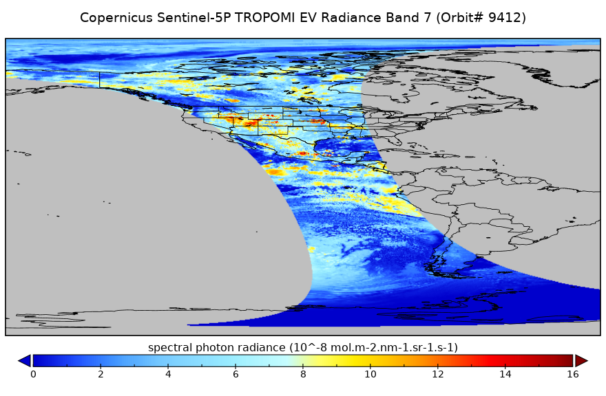
National Aeronautics and Space Administration —
Starting from August 6th in 2019, Sentinel-5P TROPOMI along-track high spatial resolution (~5.5km at nadir) has been implemented. For data before August 6th of 2019,...12,246 datasets found

Official websites use .gov
A
.gov website belongs to an official government
organization in the United States.
Secure .gov websites use HTTPS
A
lock (
) or https:// means you’ve safely connected to
the .gov website. Share sensitive information only on official,
secure websites.