
-
Federal
Spitzer Space Telescope Observation Log
National Aeronautics and Space Administration —
This database table contains the Spitzer Space Telescope (SST) log of executed and scheduled observations, and is updated on a weekly basis. Spitzer is the fourth and... -
Federal
LBA-ECO LC-24 Cadastral Property Map of Uruara, Para, Brazil: ca.1975
National Aeronautics and Space Administration —
This data set contains a shapefile of a digitized map of the land parcel information of the original properties of the Uruara colonization site, Para, Brazil,... -
Federal
BOREAS RSS-14 GOES-8 Level-1a Visible, Infrared and Water Vapor Images
National Aeronautics and Space Administration —
The BOREAS RSS-14 team collected and processed several GOES-7 and GOES-8 image data sets that covered the BOREAS study region. The level-1a GOES-8 images were created... -
Federal
West Africa Coastal Vulnerability Mapping: Subset of Global Mammal and Amphibian Richness Grids, 2015 Release
National Aeronautics and Space Administration —
The West Africa Coastal Vulnerability Mapping: Subset of Global Mammal and Amphibian Richness Grids, 2015 Release was extracted from the NASA Socioeconomic Data and... -
Federal
BOREAS TE-10 Leaf Gas Exchange Data
National Aeronautics and Space Administration —
The BOREAS TE-10 team collected several data sets in support of its efforts to characterize and interpret information on the reflectance, transmittance, gas exchange,... -
Federal
VIIRS/NPP BRDF/Albedo Valid Observation Band M4 Daily L3 Global 30ArcSec CMG V001
National Aeronautics and Space Administration —
The VNP43D45 Version 1 data product was decommissioned on July 31, 2025. Users are encouraged to use theFederalVIIRS/NPP BRDF/Albedo Snow Status Daily L3 Global 30ArcSec CMG V002
National Aeronautics and Space Administration —
The NASA/NOAA Suomi National Polar-orbiting Partnership (Suomi NPP) Visible Infrared Imaging Radiometer Suite (VIIRS) Bidirectional Reflectance Distribution Function...FederalGroth-Westphal Strip Chandra X-Ray Point Source Catalog
National Aeronautics and Space Administration —
This table contains the optical and X-ray spectral properties of the sources detected in a 200-ks Chandra observation of part of the Groth-Westphal Strip (GWS)...FederalBeXRB Monitor Data API
National Aeronautics and Space Administration —
A fully queryable REST API with JSON, XML, and CSV output as well as inline, runable examples. This is a monitor using data from Swift/BAT, MAXI and Fermi/GBM...FederalROSETTA-ORBITER 67P RSI 1/2/3 COMET ESCORT 1 0505 V1.0
National Aeronautics and Space Administration —
This is a Rosetta Radio Science data set, collected during the COMET ESCORT 1 phase 2014-11-20 to 2015-03-10. It is a Global Gravity measurement at the comet 67P and...FederalSBUV2/NOAA-19 Ozone (O3) Profile and Total Column Ozone 1 Month Zonal Mean L3 Global 5.0 degree Latitude Zones V1 (SBUV2N19L3zm) at GES DISC
National Aeronautics and Space Administration —
The Solar Backscattered Ultraviolet (SBUV) from NOAA-19 Level-3 monthly zonal mean (MZM) product (SBUV2N19L3zm) is derived from the Level-2 retrieved ozone profiles....Federal['RNA sequencing of zebrafish embryos under simulated microgravity conditions']
National Aeronautics and Space Administration —
['To reveal the potential mechanisms involved in the dysfunction of antiviral immune responses under simulated microgravity conditions, we investigated the...FederalLBA-ECO ND-01 Streamwater and Watershed Characteristics, Rondonia, Brazil: 1998-1999
National Aeronautics and Space Administration —
This data set provides the results of (1) synoptic streamwater sampling and analyses from numerous sites across Rondonia and (2) corresponding watershed...FederalMISR Level 3 FIRSTLOOK Component Global Land Product covering a month V002
National Aeronautics and Space Administration —
MI3MLSF_002 is the Multi-angle Imaging SpectroRadiometer (MISR) Level 3 FIRSTLOOK Component Global Land Product covering a month version 2 data product. It contains a...FederalBOREAS RSS-19 1994 CASI At-Sensor Radiance and Reflectance Images
National Aeronautics and Space Administration —
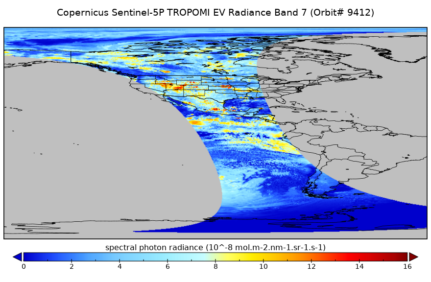
The RSS-19 team collected CASI images from the Chieftain Navaho aircraft in order to observe the seasonal change in the radiometric reflectance properties of the...FederalSentinel-5P TROPOMI Near-Real-Time (NRT) Radiance product band 7 (SWIR detector) L1B 5.5km x 7km V2 (S5P_L1B_RA_BD7_HiR_NRT) at GES DISC
National Aeronautics and Space Administration —
The Sentinel-5P TROPOMI Near Real Time (NRT) Radiance product band 7 (SWIR detector) L1B 5.5km x 21km V2 (S5P_L1B_RA_BD7_HiR_NRT) product at GES DISC is the near real...FederalIMP 8 Cosmic Ray Nuclear Composition (CRNC) 15-min PHA and coincidence mode counts
National Aeronautics and Space Administration —
This 15-min-resolution data set consists of 5 count rates from the Low Energy Telescope, \n 8 count rates for the main telescope (MT), 4 counts of pulse height...FederalVIIRS/NPP Thermal Anomalies/Fire 6-Min L2 Swath 750m V002
National Aeronautics and Space Administration —
The Visible Infrared Imaging Radiometer Suite (VIIRS) Thermal Anomalies (VNP14) Version 2 product is produced in 6-minute temporal satellite increments (swaths) at...FederalIceBridge HiCARS 1 L0 Raw Return Energy Amplitudes, Version 1
National Aeronautics and Space Administration —
This data set contains radar sounder measurements taken over Antarctica using the Hi-Capability Radar Sounder (HiCARS) Version 1 instrument. The data were collected...12,246 datasets found

Official websites use .gov
A
.gov website belongs to an official government
organization in the United States.
Secure .gov websites use HTTPS
A
lock (
) or https:// means you’ve safely connected to
the .gov website. Share sensitive information only on official,
secure websites.