
-
Federal
Global Navigation Satellite System (GNSS) IGS Final Combined Orbit Solution Summary Product from NASA CDDIS
National Aeronautics and Space Administration —
This derived product set consists of Global Navigation Satellite System Final Orbit/Reference Frame Product Summary from the NASA Crustal Dynamics Data Information... -
Federal
DISCOVER-AQ Colorado Deployment Ancillary Model Data
National Aeronautics and Space Administration —
DISCOVERAQ_Colorado_Model_Data contains ancillary model analysis collected during the Colorado (Denver) deployment of NASA's DISCOVER-AQ field study and features data... -
Federal
BARREL 1D Data Processing Unit (HKPG) Analog Housekeeping Voltage, Temperature, Current, and Payload Status, Level 2, 40 s Data
National Aeronautics and Space Administration —
Housekeeping voltage, temperature, current, and payload status values returned every 40 s. NOTE: The analog sensor data in these records are based on the nominal... -
Federal
ER-2 X-band Radar (EXRAD) 3D Winds IMPACTS V1
National Aeronautics and Space Administration —
The ER-2 X-band Radar (EXRAD) 3D Winds IMPACTS dataset consists of horizontal wind components, uncertainties in the horizontal wind components, and radar reflectivity... -
Federal
NGC 4472 Chandra X-Ray Point Source Catalog
National Aeronautics and Space Administration —
The Chandra X-Ray Point Source Catalog of the giant elliptical galaxy NGC 4472 contains the results of a Chandra ACIS-S/Hubble Space Telescope (HST) study of the... -
Federal
NASA SCP Arctic and Antarctic Ice Extent from QuikSCAT, 1999-2009, Version 2
National Aeronautics and Space Administration —
This data set provides sea ice extent for the Arctic (60-90 degrees North) and Antarctic (52-90 degrees South) in Scatterometer Image Reconstruction (SIR) binary... -
Federal
VIIRS/JPSS1 BRDF/Albedo NBAR at Solar Noon Band M4 Daily L3 Global 30ArcSec CMG V002
National Aeronautics and Space Administration —
The NOAA-20 Visible Infrared Imaging Radiometer Suite (VIIRS) Bidirectional Reflectance Distribution Function (BRDF) and Albedo Nadir BRDF-Adjusted Reflectance (NBAR)... -
Federal
SCOAPE R/V Point Sur Data
National Aeronautics and Space Administration —
SCOAPE_RVPointSur_Data is the data collected from instruments onboard the University of Southern Mississippi’s Research Vessel (R/V) Point Sur during the Satellite... -
Federal
BARREL 2W Rate Counter (RCNT) NaI Scintillator Diagnostics, Level 2, 4 s Data
National Aeronautics and Space Administration —
This data product consists of measurements from rate counters. The rate count data are diagnostic fields, have uncalibrated energy ranges, and wrap near or above... -
Federal
LBA Regional Climate Data, 0.5-Degree Grid, 1960-1990 (Willmott and Webber)
National Aeronautics and Space Administration —
This data set is a subset of a 0.5-degree gridded temperature and precipitation data set for South America (Willmott and Webber 1998). This subset was created for the... -
Federal
SAFARI 2000 Leaf Area Index and Canopy Structure, Kalahari Transect, 1999-2000
National Aeronautics and Space Administration —
Data from the Tracing Radiation and Architecture of Canopies (TRAC) instrument were collected at five sites along the International Geosphere-Biosphere Programme... -
Federal
CMS: LiDAR-derived Aboveground Biomass, Canopy Height and Cover for Maryland, 2011
National Aeronautics and Space Administration —
This data set provides 30-meter gridded estimates of aboveground biomass (AGB), canopy height, and canopy coverage for the state of Maryland in 2011. Leaf-off LiDAR... -
Federal
SAFARI 2000 Meteorological Tower Measurements, Kruger National Park, 2000-2002
National Aeronautics and Space Administration —
An eddy covariance system mounted on a tower near the Skukuza Camp in Kruger National Park, South Africa, has been operating continuously since early 2000.... -
Federal
High Mountain Asia 5 Arc-Minute Hydrological Flow Direction for the Headwaters of the Amu Darya and Indus River Basins V001
National Aeronautics and Space Administration —
TEMP: This High Mountain Asia (HMA) data set consists of a 5 arc-minute hydrological flow network for parts of Afghanistan, Tajikistan, Kyrgyzstan, and Pakistan... -
Federal
AIRSAR_ALONGTRACK_INTERFEROMETRY_JPG
National Aeronautics and Space Administration —
AIRSAR along-track interferometric browse product JPG -
Federal
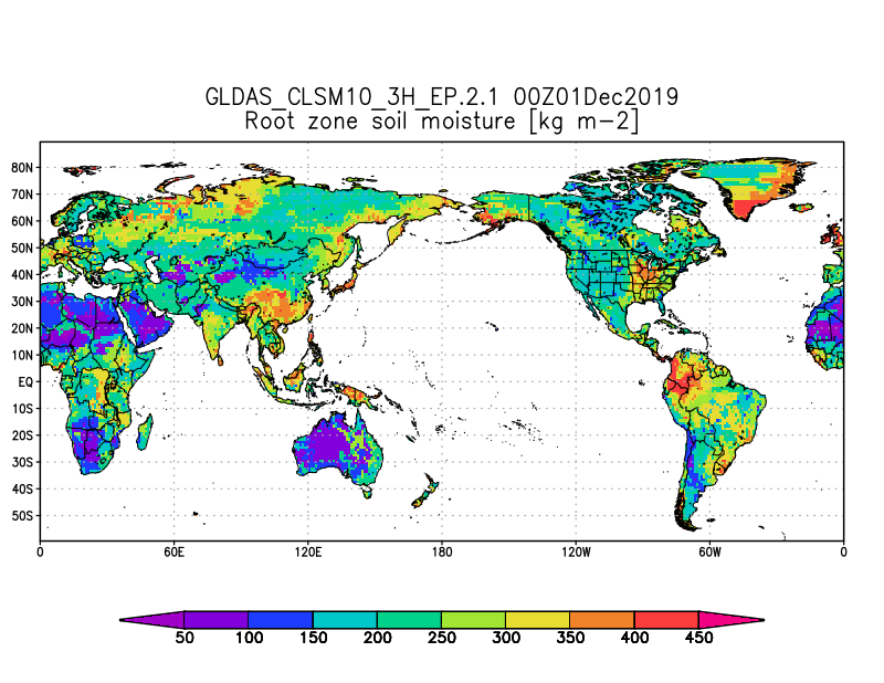
GLDAS Catchment Land Surface Model L4 3 hourly 1.0 x 1.0 degree Early Product V2.1 (GLDAS_CLSM10_3H_EP) at GES DISC
National Aeronautics and Space Administration —
NASA Global Land Data Assimilation System Version 2 (GLDAS-2) has three components: GLDAS-2.0, GLDAS-2.1, and GLDAS-2.2. GLDAS-2.0 is forced entirely with the... -
Federal
TES/Aura L2 Carbonyl Sulfide Nadir V007
National Aeronautics and Space Administration —
TL2OCSN_7 is the Tropospheric Emission Spectrometer (TES)/Aura Level 2 Atmospheric Temperatures Limb Version 7 data product. TES was an instrument aboard NASA's Aura... -
Federal
VIIRS/SNPP Water Vapor Level-3 daily 0.5 x 0.5 degree grid
National Aeronautics and Space Administration —
The VIIRS/SNPP Water Vapor Level-3 daily 0.5 x 0.5 degree grid Product provide total column water vapor (TPW) properties from merged VIIRS infrared measurements and... -
Federal
VIIRS/JPSS1 BRDF/Albedo Parameter 3 Band M1 Daily L3 Global 30 ArcSec CMG V002
National Aeronautics and Space Administration —
The NOAA-20 Visible Infrared Imaging Radiometer Suite (VIIRS) Bidirectional Reflectance Distribution Function (BRDF) and Albedo Model Parameter 3 Band M1 product... -
Federal
SMEX03 ASTER Level-1B Data: Oklahoma, Version 1
National Aeronautics and Space Administration —
This data set contains mosaicked Advanced Spaceborne Thermal Emission and Reflection Radiometer (ASTER) images for the Oklahoma North and Oklahoma South, USA regional...

Official websites use .gov
A
.gov website belongs to an official government
organization in the United States.
Secure .gov websites use HTTPS
A
lock (
) or https:// means you’ve safely connected to
the .gov website. Share sensitive information only on official,
secure websites.