
-
Federal
MODIS/Terra Leaf Area Index/FPAR 8-Day L4 Global 500m SIN Grid V061
National Aeronautics and Space Administration —
The MOD15A2H Version 6.1 Moderate Resolution Imaging Spectroradiometer (MODIS) combined Leaf Area Index (LAI) and Fraction of Photosynthetically Active Radiation... -
Federal
OMI/Aura Ozone (O3) Total Column 1-Orbit L2 Swath 13x24 km V003 NRT
National Aeronautics and Space Administration —
The OMI/Aura Level-2 Total Column Ozone Data Product OMTO3 Near Real Time data is made available from the OMI SIPS NASA for the public access. The Ozone Monitoring... -
Federal
WorldView-2 Level 2A Multispectral 8-Band Satellite Imagery
National Aeronautics and Space Administration —
The WorldView-2 Level 2A Multispectral 8-Band Imagery collection contains satellite imagery acquired from Maxar Technologies (formerly known as DigitalGlobe) by the... -
Federal
Gridded Population of the World, Version 3 (GPWv3): Population Density Grid, Future Estimates
National Aeronautics and Space Administration —
The Gridded Population of the World, Version 3 (GPWv3): Population Density Grid, Future EstimatesFuture Estimates consists of estimates of human population for the... -
Federal
Weather Research and Forecasting (WRF) Model IMPACTS
National Aeronautics and Space Administration —
The Weather Research and Forecasting (WRF) Model IMPACTS dataset includes model data simulated by the Weather Research and Forecasting (WRF) model for the... -
Federal
TES/Aura L3 Ozone Daily Gridded V006
National Aeronautics and Space Administration —
TL3O3D_6 is the Tropospheric Emission Spectrometer (TES)/Aura L3 Ozone Daily Gridded Version 6 data product. TES was an instrument aboard NASA's Aura satellite and... -
Federal
MSS 1-5 (1972-1987)
National Aeronautics and Space Administration —
The USGS Earth Resources Observation and Science (EROS) Center archive holds data collected by the Landsat suite of satellites, beginning with Landsat 1 in 1972. All... -
Federal
FERMIGTRIG - Fermi GBM Trigger Catalog
National Aeronautics and Space Administration —
This table lists all of the triggers observed by one or more of the 14 GBM detectors (12 NaI and 2 BGO). Note that there are two Browse catalogs resulting from GBM... -
Federal
NASA Landsat Data Collection
National Aeronautics and Space Administration —
The NASA Landsat Data Collection (NLDC) is a compilation of Landsat multispectral scanner (MSS) scenes and Landsat thematic mapper (TM) scenes. This compilation of... -
Federal
CERES and GEO-Enhanced TOA, Within-Atmosphere and Surface Fluxes, Clouds and Aerosols Daily Terra Edition4A
National Aeronautics and Space Administration —
CER_SYN1deg-Day_Terra-MODIS_Edition4A is the Clouds and the Earth's Radiant Energy System (CERES) and geostationary (GEO)-Enhanced Top-of-Atmosphere (TOA) and Surface... -
Federal
ARCTAS DC-8 Aircraft In-situ Aerosol Data
National Aeronautics and Space Administration —
ARCTAS_Aerosol_AircraftInSitu_DC8_Data is the in-situ aerosol data for the DC-8 aircraft collected during the Arctic Research of the Composition of the Troposphere... -
Federal
ISIS 2 Topside Sounder Ionograms
National Aeronautics and Space Administration —
These ionograms were digitized from the original ISIS-2 7-track analog telemetry tapes using the facilities of the former Data Evaluation Laboratory at the NASA/GSFC.... -
Federal
Lynds Catalog of Dark Nebulae
National Aeronautics and Space Administration —
This catalog is an updated version of the original version of the Lynds' Catalog of Dark Nebulae that was published in 1962. The catalog was based on a study of the... -
Federal
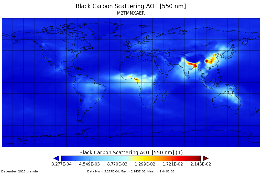
MERRA-2 tavgM_2d_aer_Nx: 2d,Monthly mean,Time-averaged,Single-Level,Assimilation,Aerosol Diagnostics 0.625 x 0.5 degree V5.12.4 (M2TMNXAER) at GES DISC
National Aeronautics and Space Administration —
M2TMNXAER (or tavgM_2d_aer_Nx) is a time-averaged 2-dimensional monthly mean data collection in Modern-Era Retrospective analysis for Research and Applications... -
Federal
Crab Pulsar Timing
National Aeronautics and Space Administration —
The CRABTIME database contains the Crab Pulsar Monthly Ephemeris covering the period from Feb 15 1982 (MJD=45015) to (close to) the present that was created Dr.... -
Federal
VIIRS/NPP Land Surface Temperature/Emissivity Daily L3 Global 1km SIN Grid Night V001
National Aeronautics and Space Administration —
The VNP21A1N VIIRS Version 1 data product was decommissioned on April 8th, 2025. Users are encouraged to use Version 2 data products, which provideFederalThird Catalog of Hard Fermi-LAT Sources (3FHL)
National Aeronautics and Space Administration —
This is a catalog of sources detected above 10 GeV by the Fermi-Large Area Telescope (LAT) in the first 7 years of data using the Pass 8 event-level analysis. It...FederalGlobal Navigation Satellite System (GNSS) IGS Final Cumulative Combined Set of Station Coordinates Product from NASA CDDIS
National Aeronautics and Space Administration —
This derived product set consists of Global Navigation Satellite System Final Cumulative Station Positions/Velocities (no covariance matrix) Product available from...FederalCYGNSS Level 1 Science Data Record Version 3.2
National Aeronautics and Space Administration —
This CYGNSS Level 1 (L1) science data record dataset contains the version 3.2 geo-located Delay Doppler Maps (DDMs) calibrated into Power Received (Watts) and...12,246 datasets found

Official websites use .gov
A
.gov website belongs to an official government
organization in the United States.
Secure .gov websites use HTTPS
A
lock (
) or https:// means you’ve safely connected to
the .gov website. Share sensitive information only on official,
secure websites.