


26 datasets found
-
Federal
Maximum demand charge rates for commercial and industrial electricity tariffs in the United States
Department of Energy —
NREL has assembled a list of U.S. retail electricity tariffs and their associated demand charge rates for the Commercial and Industrial sectors. The data was obtained... -
Federal
United States Geothermal Direct-Use Database - 2025 Update
Department of Energy —
This database of geothermal direct-use systems in the U.S. was updated as part of the Geothermal Market Report from the National Renewable Energy Laboratory (NREL).... -
Federal
Snake River Plain FORGE: Site Characterization Data
Department of Energy —
The site characterization data used to develop the conceptual geologic model for the Snake River Plain site in Idaho, as part of phase 1 of the Frontier Observatory... -
Federal
Utah FORGE: Phase 2C Seismic Observation and Ground Water Well Data and Well Locations
Department of Energy —
This submission contains the following data associated with Utah FORGE Phase 2C within the Roosevelt Hot Springs geothermal area: - An ArcGIS shapefile with well... -
Federal
Fallon FORGE: GIS and Downhole Well Lithology Data
Department of Energy —
ArcGIS Map Package with MT Station Locations, 2D Seismic Lines, Well data, Known Regional Hydrothermal Systems, Regional Historic Earthquake Seismicity, Regional... -
Federal
Utah FORGE: Well 78-32 Capacity Test
Department of Energy —
This dataset includes an Excel spreadsheet with Utah FORGE Phase 2c Well 78-32 capacity data. It also includes a readme file discussing the data which also includes... -
Federal
Utah FORGE: Well 16A(78)-32 Planned Trajectory
Department of Energy —
This submission includes an Excel spreadsheet containing the Utah FORGE deep well 16A(78)-32 planned trajectory including UTM coordinates, elevations, and depths from... -
Federal
New Mexico Geothermal Play Fairway Analysis from LANL
Department of Energy —
This submission contains geospatial (GIS) data on water table gradient and depth, subcrop gravity and magnetic, propsectivity, heat flow, physiographic, boron and BHT... -
Federal
Utah FORGE: Well 16A(78)-32 2022 Stimulation Microseismic Report
Department of Energy —
This is a Utah FORGE well 16A(78)-32 stimulation microseismic detection and event location report from Silixa LLC. The report covers the digital acoustic sensing... -
Federal
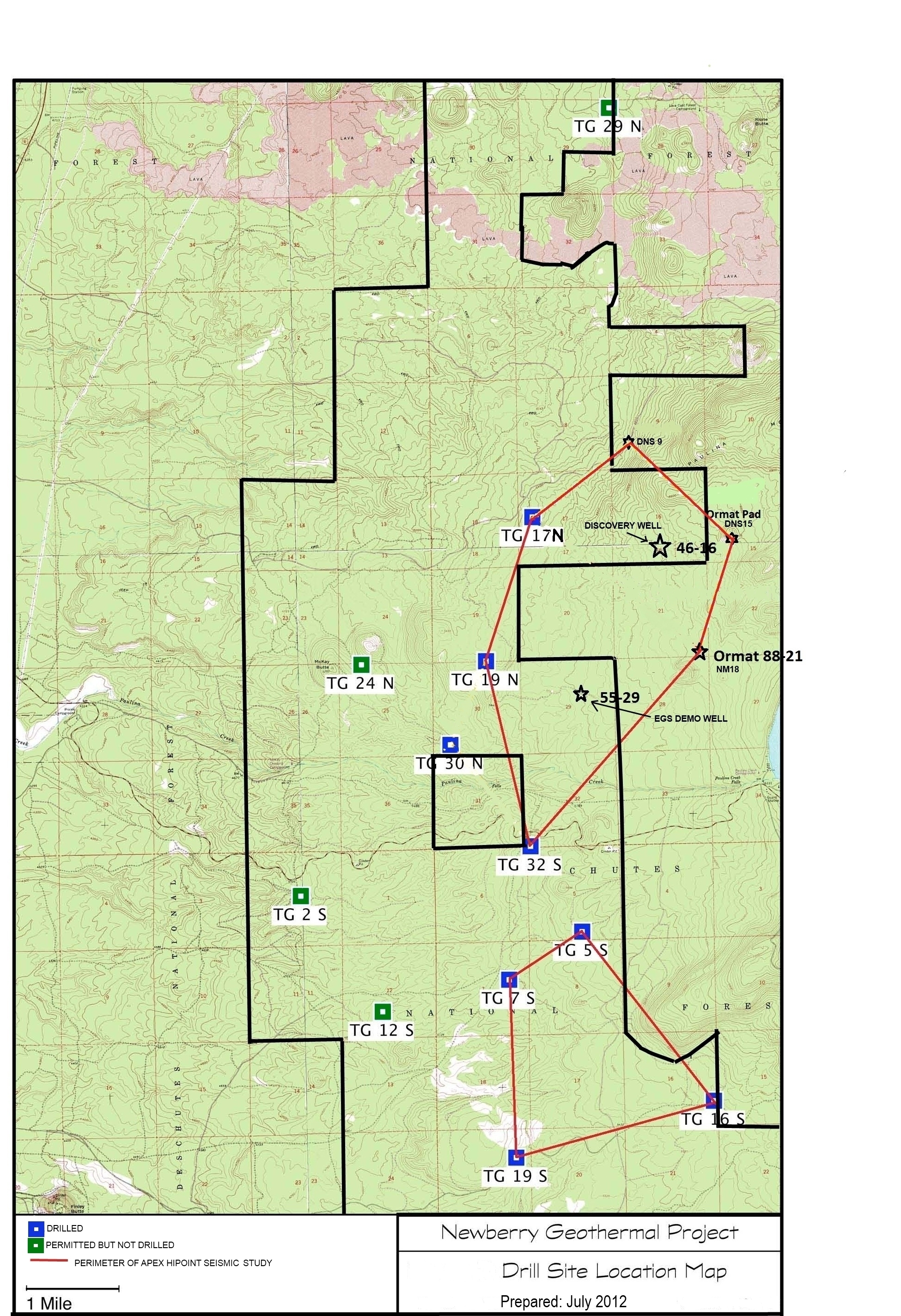
Map of Validation of Innovative Exploration Technologies for Newberry Volcano
Department of Energy —
A map showing location of wells permitted, drilled and seismic test, as part of validation of innovative exploration technologies done for the Newberry Volcano... -
Federal
RivGen Acoustic Measurements, Igiugig, AK
Department of Energy —
Drifting hydrophone measurements obtained around the Ocean Renewable Power Company RivGen turbine near the village of Igiugig, Alaska in August, 2014. Each data set... -
Federal
Validation of Innovative Exploration Technologies for Newberry Volcano: Drill Site Location Map
Department of Energy —
Newberry seeks to explore "blind" (no surface evidence) convective hydrothermal systems associated with a young silicic pluton on the flanks of Newberry Volcano. This... -
Federal
Northwest National Marine Renewable Energy Center, OR - Project Plans
Department of Energy —
Plans for Northwest National Marine Renewable Energy Center (NNMREC) Project. Mobile Ocean Test Berth (MOTB) plans PMEC-SETS Plans -
Federal
Seismic Line Location Map, Hot Pot Project, Humboldt County, Nevada 2010
Department of Energy —
Seismic Line Location Map Hot Pot Project, Humboldt County, Nevada 2010. Detailed map (pdf) showing topographic base map, Township and Range layer, Oski BLM and... -
Federal
Fallon FORGE: ArcGIS Site Location and Geologic Model Range Polygons
Department of Energy —
A zip file containing two ArcGIS polygons of the FORGE site located in Fallon, Nevada. FallonFORGE3DGeologicModelRange is the 3D geologic model range and... -
Federal
Seismic Line Location Map File, Hot Pot Project, Humboldt County, Nevada 2010
Department of Energy —
Location of seismic lines carried out under DOE funded project Advanced Seismic Data Analysis Program (The Hot Pot Project). ArcGIS map package containing topographic... -
Federal
West Flank Coso FORGE: MT Station Locations
Department of Energy —
This data includes the locations of the MT data collected in and around the Coso Geothermal field that covered the West Flank area. These are the data that the 3D MT... -
Federal
Seismic Analysis of Spatio-Temporal Fracture Generation During EGS Resource Development - Deviatoric MT, Fracture Network, and Final Report
Department of Energy —
This submission contains 167 deviatoric moment tensor (MT) solutions for the seismicity observed two years prior and three years post start of injection activities at...

26 datasets found